SACRAMENTO, California —
The latest batch of unsettled weather to pass through Northern California produced more precipitation than originally forecast, but totals were still on the light side although more rain and snow is on the way later in the week.
Valley rain totals were originally forecast to be zero for most of the region, but most of the Sacramento Valley picked up at least a few hundredths of an inch of rain and some areas got closer to a quarter of an inch on Saturday morning. Sacramento Executive Airport received 0.12" in total.
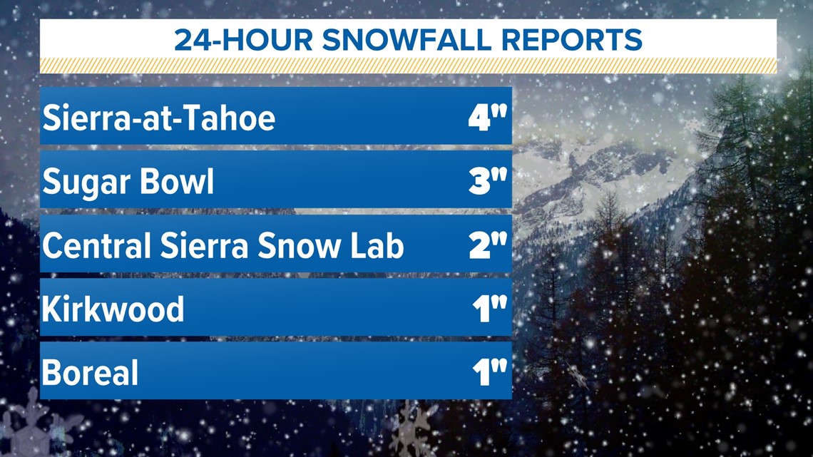
Snow totals were on the light side as well, with the snowiest locations only picking up 4” of fresh snow.

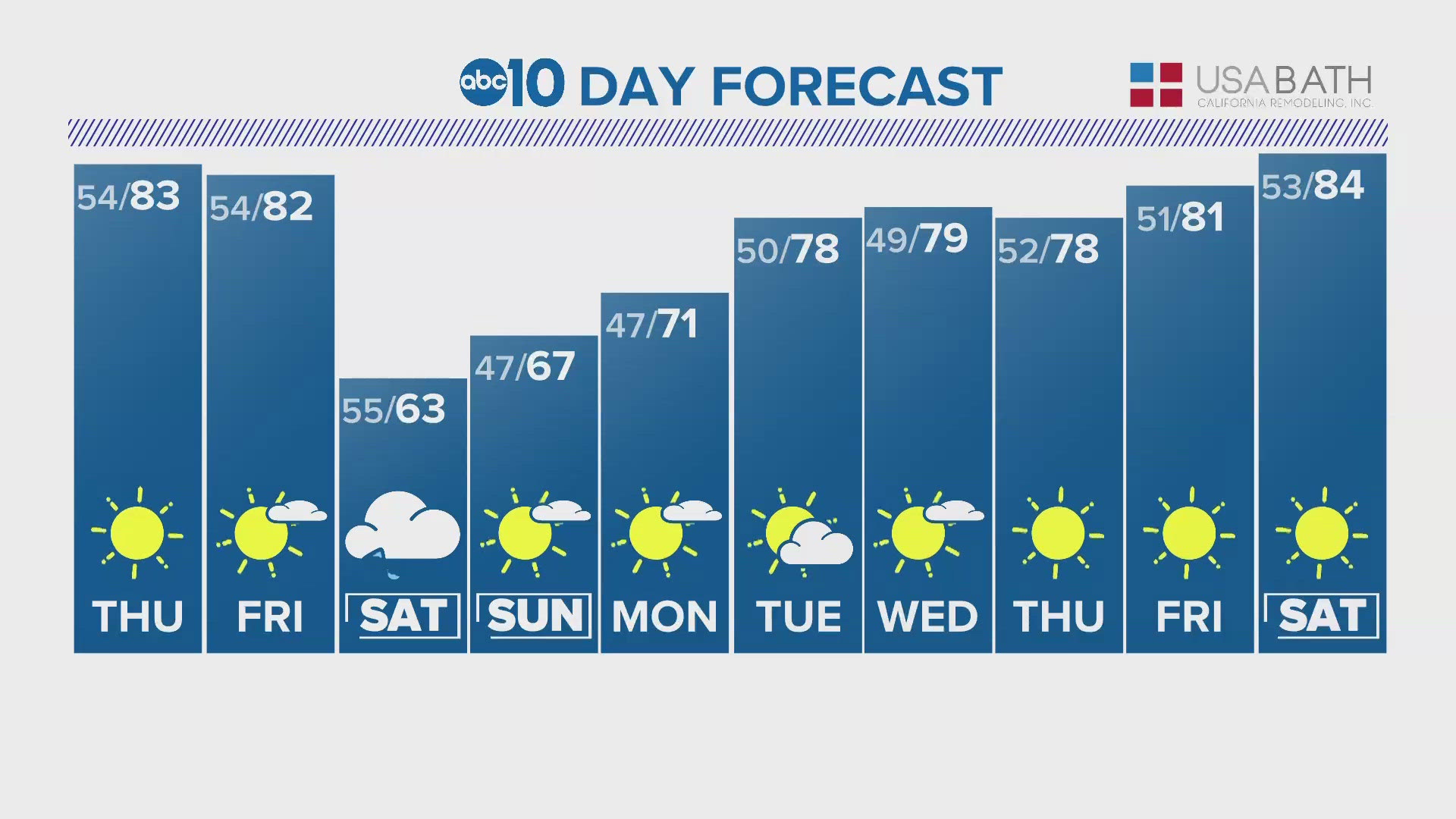
High pressure will be the dominant feature for California weather through the first half of the week and temperatures will rise well above climatological average. Valley high temperatures are forecast to be into the mid 60s on Monday and Tuesday. Wednesday will be a few degrees cooler as a system of low pressure moves closer to the coast.
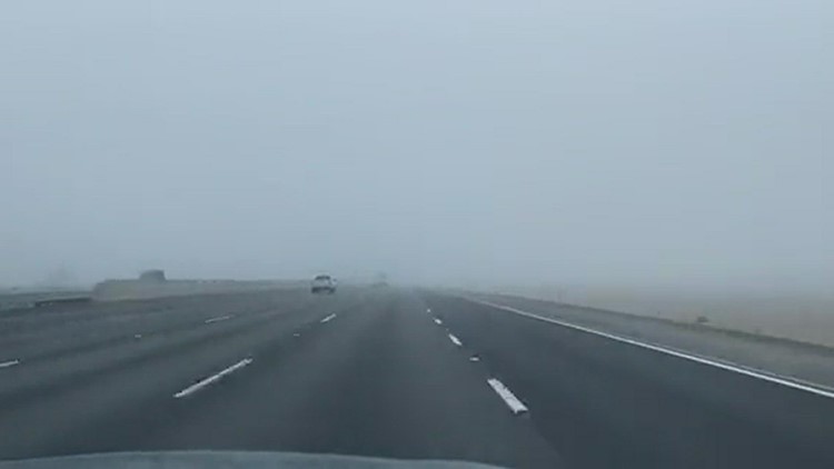
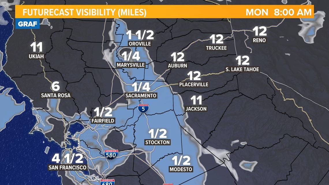
Thanks to the recent rainfall, light winds, and clear skies, patchy fog is expected to develop in the valley on Monday and Tuesday, mainly south of Marysville.

Low pressure will move over California by late Wednesday and high temperatures will subsequently dip back into the 50s by Thursday and Friday. The average high in Sacramento for this time of year is 58 degrees and the average low is 41 degrees.
Low temperatures will also be on the warmer side to start the week, but 30s are expected again by the end of the week and into the weekend.
The low pressure system will boost precipitation chances also, particularly Wednesday through Friday. Don't expect too much out of this system, however. As has been the case lately, this system will be on the weak side and will only deliver light rain and snow to Northern California.
Rain totals will generally decrease as you head south, and areas south of Sacramento aren't expected to see much, if any, in terms of accumulation. According to the latest data, the Sacramento area is expected to pick up less than a tenth of an inch with this system.
Snow levels will be on around 7,000-8,000 feet initially but will drop to around 5,000-6,000 feet by Thursday morning. Only 1-3" is expected through Friday in the Sierra.
WATCH ALSO: