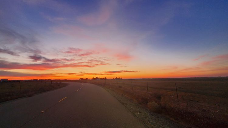
SACRAMENTO, Calif. — Northern California will go from spring-like temperatures early this week to some of the coldest air the region has experienced all year in a matter of days.
Winter is not over yet and chilly, wet weather is likely to stick around for the foreseeable future.
Warm temperatures on Monday, into the upper 60s and even the low 70s in the Central Valley, are thanks to the high pressure system influencing the mild weather.
Tuesday is when the pattern will start to shift as the high pressure moves westward, allowing for systems to move in from the north. Increasing cloud cover and strong winds will signal the ushering in of a very cold air mass originating from western Canada. Temperatures on Tuesday will be near average before dropping on Wednesday and dropping even more Thursday.
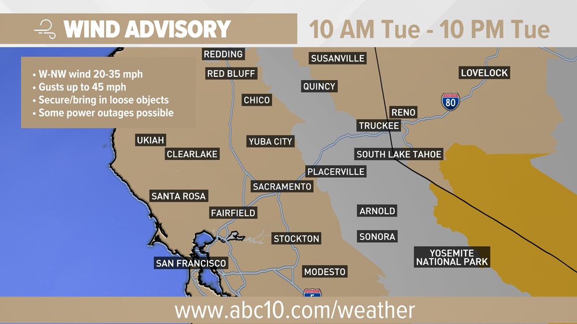
A Wind Advisory is in effect beginning 10 a.m. Thursday, affecting a wide swath of California as the system approaches. Gusts of up to 45 mph are expected.

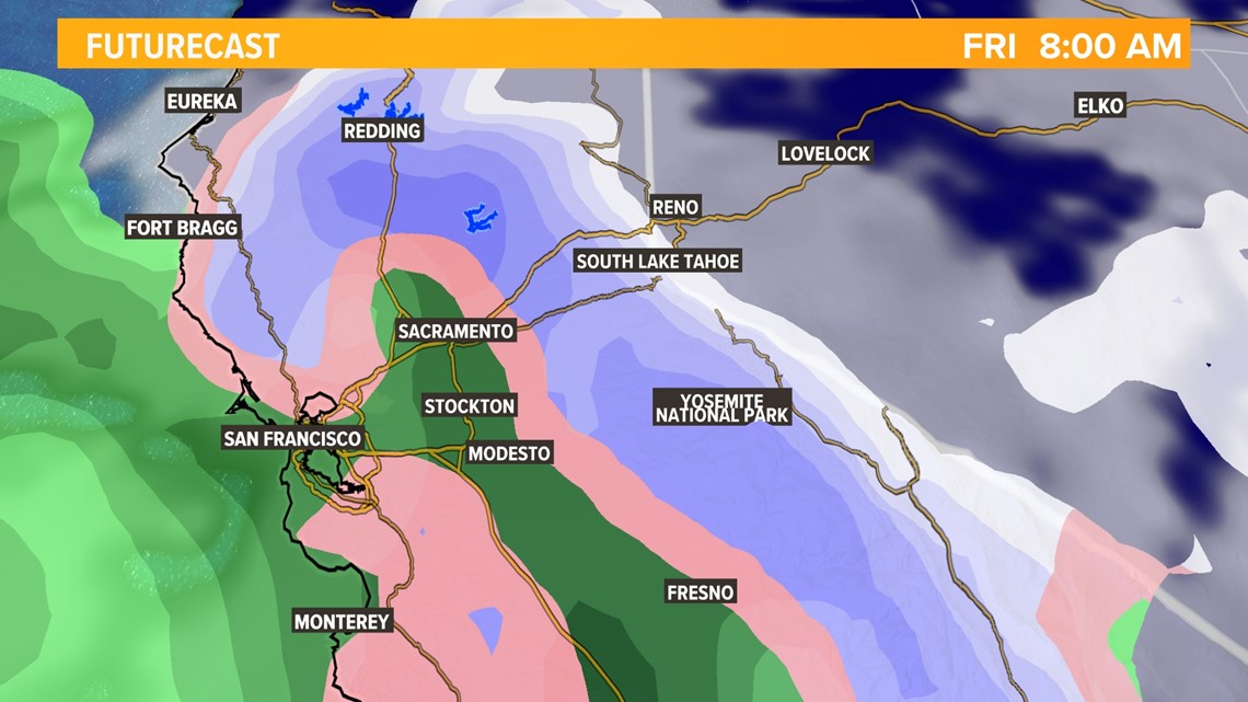
The first round of precipitation will move into the region on Tuesday. The valley won't see much rain at all as only a few isolated areas in the Sacramento Valley have chances. The first system will mainly impact the Sierra, dropping snow above 4,500 feet.
By Wednesday, cooler air will have moved in dropping snow levels significantly. Wednesday morning will be dry for most areas apart from a few Sierra showers. Highs in the valley will be limited to the low 50s, 40s in the foothills, and down into the 20s and teens for the Sierra.
Thursday morning is when things could get interesting. Snow levels could drop to around 500 feet, dropping snow in areas that haven't seen snow since 2009. The high temperature in Sacramento is forecast to reach 46 degrees, far below the average of 63 for this time of year. Most of the Sierra will struggle to get out of the lower 20s and most foothill locations will struggle to reach 40 degrees. Similar high temperatures are expected on Friday.
Forecasting snow is one of the trickiest things in all of meteorology. As of now, it does look possible that some areas around 500 feet, or even below, could see a few snowflakes, likely mixed with a cold rain, on Thursday and Friday mornings.

Low elevation snow events are typically a battle between available moisture and temperatures cold enough to produce snow. This event, while light on moisture, should have enough to produce some showers across the region. The main question now is to whether temperatures will be cold enough to produce snowfall in the lower elevations where the showers roll through.
The chances of areas like downtown Sacramento, Stockton, and Modesto seeing any snowflakes is very slim as of now. The better chances lie in areas north of Sacramento along with communities closer to the foothills. Areas like Folsom, Roseville, Marysville, and Yuba City have a better chance at seeing a few snowflakes mixed in with rain but chances are still slim. Accumulation is very unlikely below 500-1,000 feet.

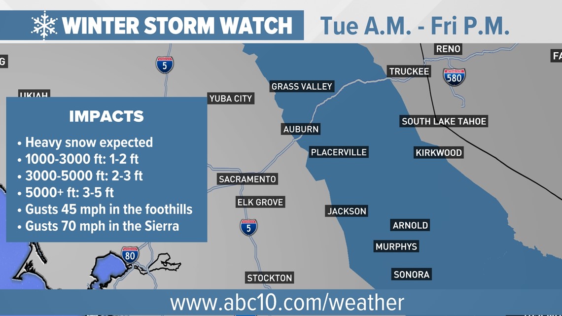
Above 1,000 feet is where significant snowfall will occur. Snow to water ratios will be quite high due to the very cold air, allowing snow to pile up quickly. Significant travel disruptions are likely in these areas along with the potential for power outages. 6-24" of snow is possible in these areas. The high Sierra will see snowfall amounts of up to five feet by Saturday.
WATCH ALSO: