
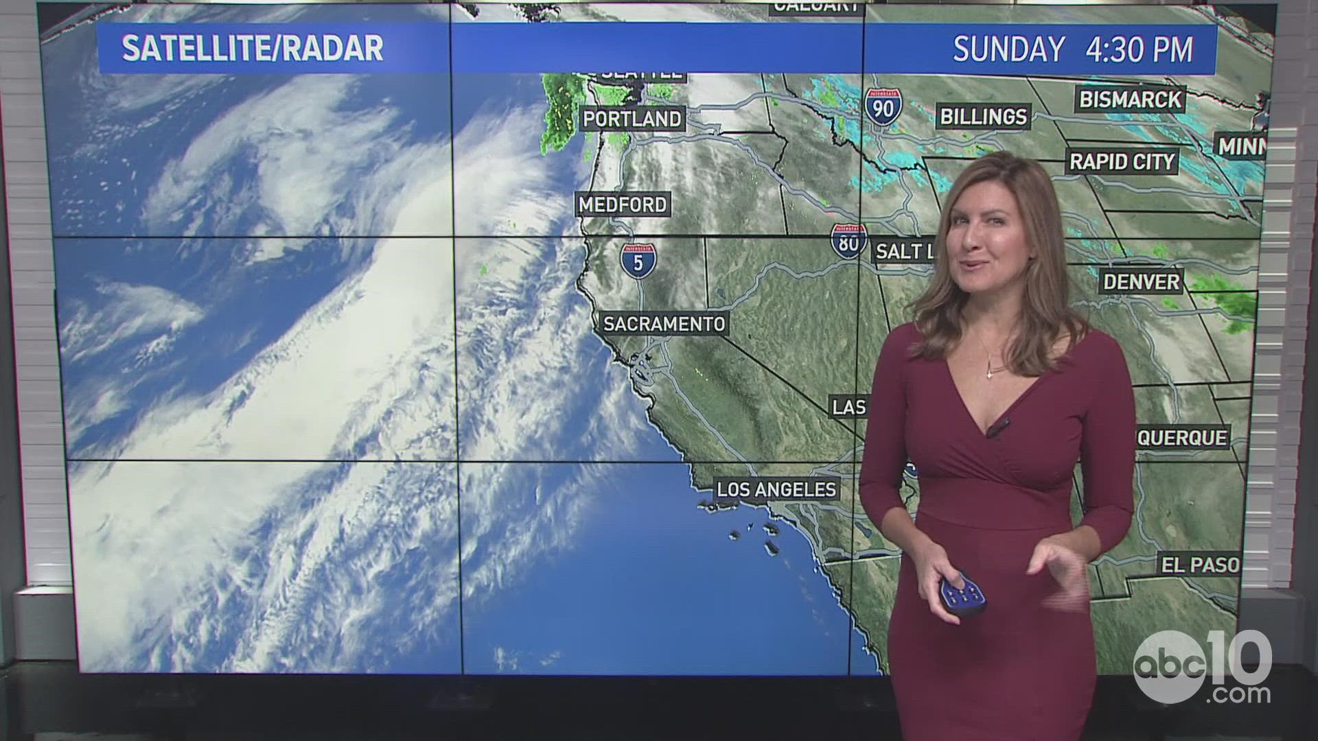
CALIFORNIA, USA — Two winter storms are forecast to hit California this week, disrupting any sense of a peaceful ride for travelers the rest of the year.
The busy holiday week starts off with a Dense Fog Advisory for most of the valley Monday through 11 a.m. Visibility will be less than a quarter mile at times.
By the evening, the first in a series of storms starts affecting the state with heavy rain and strong winds. Big travel impacts and even the potential for flooding are expected throughout the week. This prolonged series of storms will be a big shift in the dry, foggy weather.

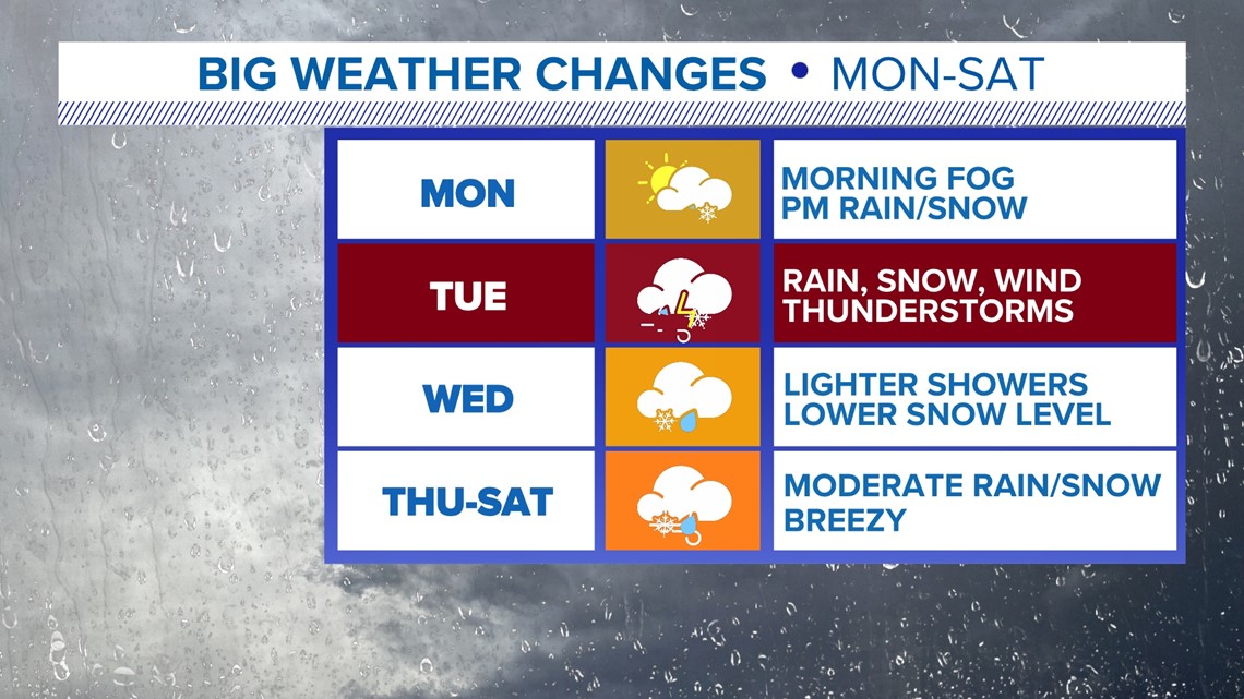
Monday starts with fog with rain beginning by the evening. Snow levels will be high initially near 7,500-8,500 feet. This will be above the passes with rain melting some snow.
Heavy rain and strong winds are expected Tuesday. Rises on small creeks and streams will be possible along with ponding on roads. Gusty winds develop with the passage of the cold front. Isolated thunderstorms are possible during the afternoon.
Snow levels drop overnight Tuesday into Wednesday to near 4,500-5,500 feet. Rain will be lighter but the snow will make mountain travel difficult with chain controls.
River levels should start to see delayed effect of Sierra runoff by Wednesday into Thursday. Sacramento River at Tisdale Weir and Cosumnes River at Michigan Bar appear to be the spots to watch toward the middle of the week.
Streams and creeks will also see impacts from the amount of heavy rain Tuesday. The valley could see 1-3" of rain by Wednesday.

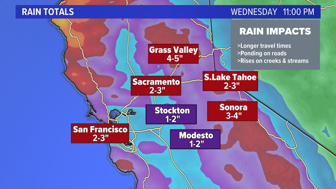
The Sierra will see a lowering snow level by Wednesday so snow will be slow to accumulate. By Wednesday, 8-30 inches are possible for the Sierra.


Storm number two arrives late Wednesday through Friday. This will bring snow levels up slightly to near 6,000 feet with periods of heavy rain and breezy weather. The winds are not expected to be as strong Tuesday.
Rain and snow totals look slightly lower for this second storm. The bottom line with this lineup though is travel will be difficult through the week.
Right now, it looks like there will be a break in the active weather Saturday evening through Sunday to ring in 2023.
Storms return to the forecast by Monday and look likely for the first full week of the new year.
► FORECAST DETAILS | Check out our hourly forecast and radar pages.
► GET WEATHER ALERTS TO YOUR PHONE | Download the ABC10 mobile app
► WEATHER IN YOUR EMAIL | Sign up for the Daily Blend Newsletter


