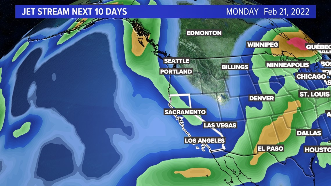
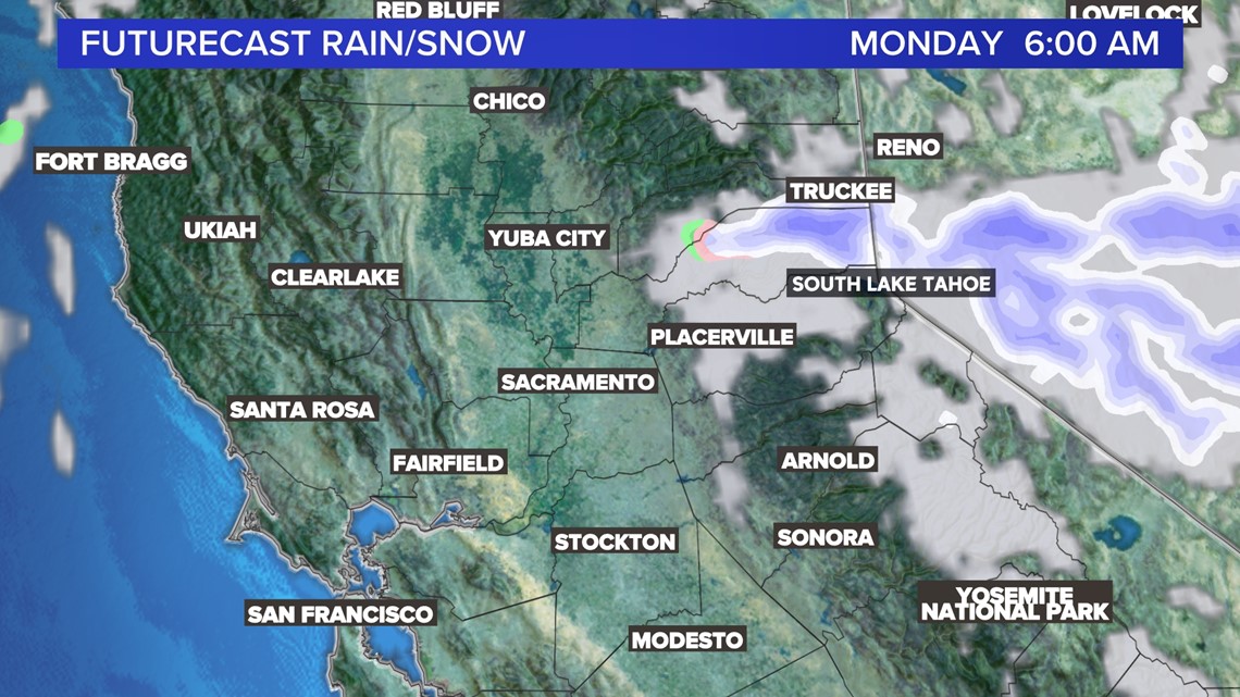
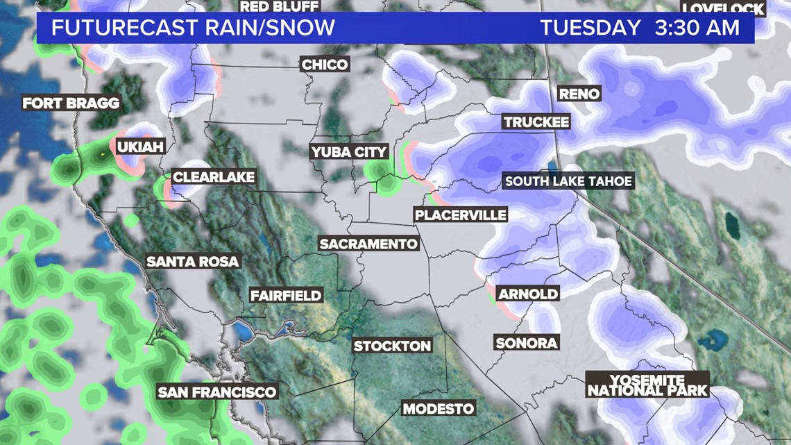
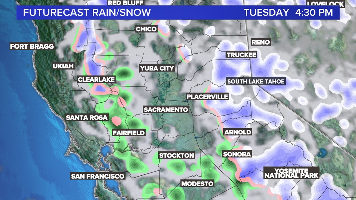
SACRAMENTO, Calif. — A low-pressure system moves in from the north Monday, as an “inside slider.” It is expected to move in from the Pacific Northwest into areas of the Sierra through Wednesday.

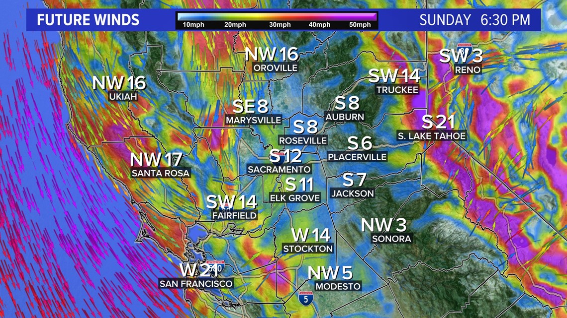
Winds will be the first weather conditions we face coming into Sunday afternoon. These winds for the valley will be around 10-20 mph with gusts for the Coastal Range and Sierra around 30-40 mph. Winds are expected to remain strong through Wednesday. This will bring renewed concerns for fire conditions.

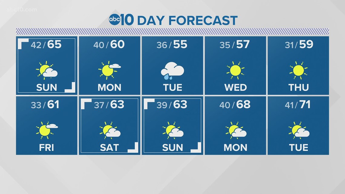
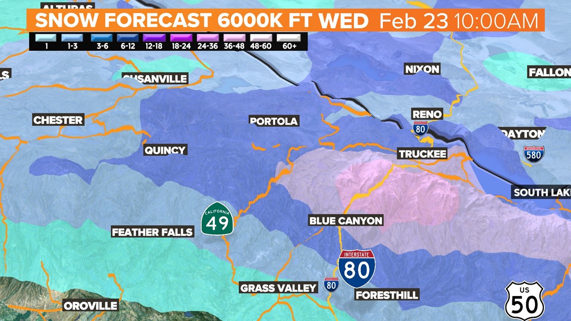
Precipitation is forecast to remain around the foothills and Sierra. Snowfall is expected to range from 3-6 inches above 6,000 feet over the three-day period. Some peaks could see 6-12 feet possible. Travel delays are possible, especially Tuesday as snow totals accumulate.

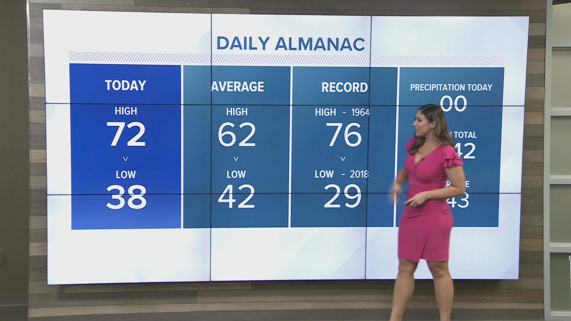
As for rainfall, Sacramento ties the record Sunday at 44 consecutive winter days without rain. If no rain is measured Monday, Sacramento will have a new dry streak record for winter at 45 days.
If the "inside slider" system stalls out or shifts more westerly, the valley may benefit from about a tenth of an inch of rain. Otherwise, most of the showers will be closer to the foothills.


Temperatures are expected to drop off into the mid-50s Tuesday and Wednesday. Temperatures overnight further fall near freezing point toward the end of the week as valley skies are clear. A freeze warning by the National Weather Service isn’t out of the question as Thursday and Friday lows will be at or below freezing.