

RIDGECREST, Calif — Update: 07/06 10 a.m.
Caltrans spokesperson Christine Knadler said that all roads around Ridgecrest are open, but asked that drivers go slow and proceed with caution.
Knadler said this includes SR-178, which was previously closed and has undergone temporary emergency repairs that have left the road with between six and eight miles of uneven pavement. She said that heavy equipment will soon go in to make permanent repairs. To keep an eye on road conditions, check the Caltrans cameras here.
Some 200 people were in shelters after a 7.1 earthquake shook the Ridgecrest area Friday night, afraid to be in their own home said Mark Ghilarducci, Director of the California Office of Emergency Services, at a press conference Saturday morning.
Ghilarducci said, fortunately, crews found very little structural damage happened as a result of the 7.1 quake.
RELATED:
Update: 07/05 10:05 p.m.
A 6.9 magnitude earthquake has hit Southern California just a day after a quake on the Fourth of July rattled the region.
The earthquake is the largest to have hit the area in the past 20 years.
On the Fourth of July an earthquake had rattled Southern California as a 6.4 magnitude earthquake hit near Ridgecrest.
Dr. Lucy Jones, a seismologist who also works for Caltech, said the earthquake from both days are part of the same sequence. The 6.4 quake from the Fourth of July is now being recognized as the foreshock to the 6.9 quake experienced Friday evening.
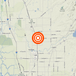
This real-time Waze maps shows the latest conditions:
Original story:
The magnitude 6.4 earthquake that struck an area of California between Los Angeles and Las Vegas on Thursday morning was the strongest quake to hit the region in 20 years.
The rolling temblor sent dozens aftershocks through the Fourth of July holiday and researchers say they could last for a week. A California official says some injuries and two house fires have been reported in a town near the epicenter.
The United States Geological Survey says on its website that their forecast over the next week includes a 9% chance of one or more aftershocks larger than the Thursday earthquake's magnitude 6.4. It is likely that there will be smaller earthquakes over the next week, with 50 to 700 magnitude 3 or higher aftershocks.
It happened near Searles Valley, California, about 125 miles northeast of Los Angeles and 125 miles west of Las Vegas. The 28,000 residents of Ridgecrest make up the biggest population concentration closest to the epicenter. The quake had a depth of 5.4 miles.
Kern County Fire Chief David Witt also told The Associated Press that emergency crews were dealing with small vegetation fires, cracks on some roads and gas leaks that were reported after the quake in the Mojave Desert.
This real-time Waze maps shows the latest conditions: