
BUTTE COUNTY, Calif. — California's interior is hot and dry and the forecast calls for a risk of fire-starting dry lightning as thousands of firefighters already have their hands full with wildland blazes.
The forecast calls for a Red Flag Warning Thursday evening through Friday evening in much of Northern California due to a chance of thunderstorms with lightning and erratic gusts.
The Dixie Fire is impacting five counties in Northern California: Butte, Plumas, Tehama, Lassen, and Shasta, according to Cal Fire. The fire has burned 927,320 acres and is still 59% contained. It has destroyed 688 homes.
In an update, Operation Section Chief Tony Brownell said the fire made a nine-mile run on Thursday and was not far from Old Station in Shasta County. He crews were engaging in structure protection in the area.
Cal Fire said conditions worsened on Thursday in the Shasta sector, specifically due to dry fuels and heavy winds. The area has become the number one priority for firefighters.
A Red Flag Warning is in effect for thunderstorms and winds through Friday. Crews are expecting gusts up to 40 mph overnight.
The Dixie Fire is roughly 100,000 acres away from becoming the largest wildfire in California state history. Currently, the largest fire in state history is the August Complex Fire from 2020. It burned 1,032,648 acres in seven counties.
Dixie Fire accounts to follow:
- Butte County Sheriff
- Butte County
- Cal Fire
- CAL FIRE Butte Unit/Butte County Fire Department
- Caltrans District 2
- Lassen County Website
- National Forest Closures
- Plumas County Sheriff's Office
- Plumas County Website
- Shasta County Website
- Shasta Sheriff Website
- Shasta 2-1-1 Dixie Info
- Code Red Sign Up
- Tehama County Website
- Tehama Sheriff Website
- Tehama Alert
Evacuations and road closures
Click HERE for in-depth evacuation orders and warnings in Plumas, Butte, Tehama, and Lassen Counties. For current state highway/route information visit roads.dot.ca.gov.
Evacuation centers
Plumas County:
- Holy Family Catholic Church at 108 Taylor Ave, Portola - AT CAPACITY
- Sparks Convention Center Hall #5, 4590 S. Virginia St., Reno, NV
Tehama County:
- Los Molinos Veterans Hall 7980 Sherwood Blvd, Los Molinos, CA
96055
NOTE: The Lassen High School shelter has closed
American Red Cross: Public Information Line (855)-755-7711
Animal Evacuation Centers:
Plumas County:
- Plumas County Fairgrounds 204 Fairground Road, Quincy
(large animals) - 201 Mill Creek Road, Quincy
(small animals) - Recreation Center 101 Meadowview Lane, Chester
Tehama County:
- Tehama County Complex 1830 Walnut Street, Red Bluff
(large and small animals)
Wildlife Rescue
- Response for injured wildlife: 1-800-942-6459
- Gold Country Wildlife Rescue: 1-530-885-0862
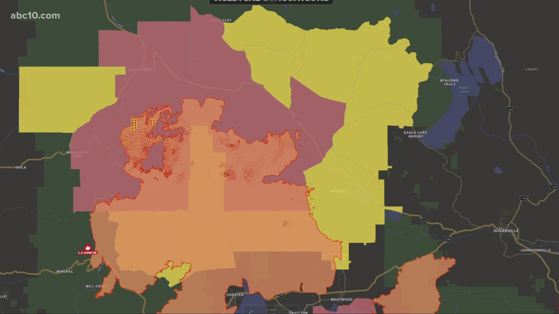
Dixie Fire Structure Status Map
A live map showing which structures have been destroyed or at risk is available below.
Evacuation Map
A live evacuation map is available below.
Wildfire Map
An updated map of the acreage of the Dixie Fire.
►Stay in the know! Sign up now for the Daily Blend Newsletter
WILDFIRE PREPS
According to Cal Fire, 2020 was one of the most severe fire seasons on record as 9,917 wildfires burned 4.2 million acres. Over 9,000 structures were destroyed, and 31 people (civilians and firefighters) were killed.
California also experienced its first "Gigafire" because of the August Complex Fire, burning over 1 million acres by itself. Four of California's top five largest wildfires in state history happened in 2020.
If you live in a wildfire-prone zone, Cal Fire suggests creating a defensible space around your home. Defensible space is an area around a building in which vegetation and other debris are completely cleared. At least 100 feet is recommended.
The Department of Homeland Security suggests assembling an emergency kit that has important documents, N95 respirator masks, supplies to grab with you if you’re forced to leave at a moment’s notice. The agency also suggests signing up for local warning system notifications and know your community’s evacuation plans best to prepare yourself and your family in cases of wildfires.
Some counties use Nixle alerts to update residents on severe weather, wildfires, and other news. To sign up, www.nixle.com or text your zip code to 888777 to start receiving alerts.
PG&E customers can also subscribe to alerts via text, email, or phone call. If you're a PG&E customer, visit the Profile & Alerts section of your account to register.
WATCH MORE ON ABC10: Dixie Fire 7:30 p.m. update: September 8th, 2021 | California Wildfires