
NEVADA COUNTY, Calif. — Firefighters battling the 904-acre Rices Fire in Nevada County saw containment increase Saturday.
The Rices Fire, which started Tuesday near Rices Crossing in Nevada County, is 35% contained.
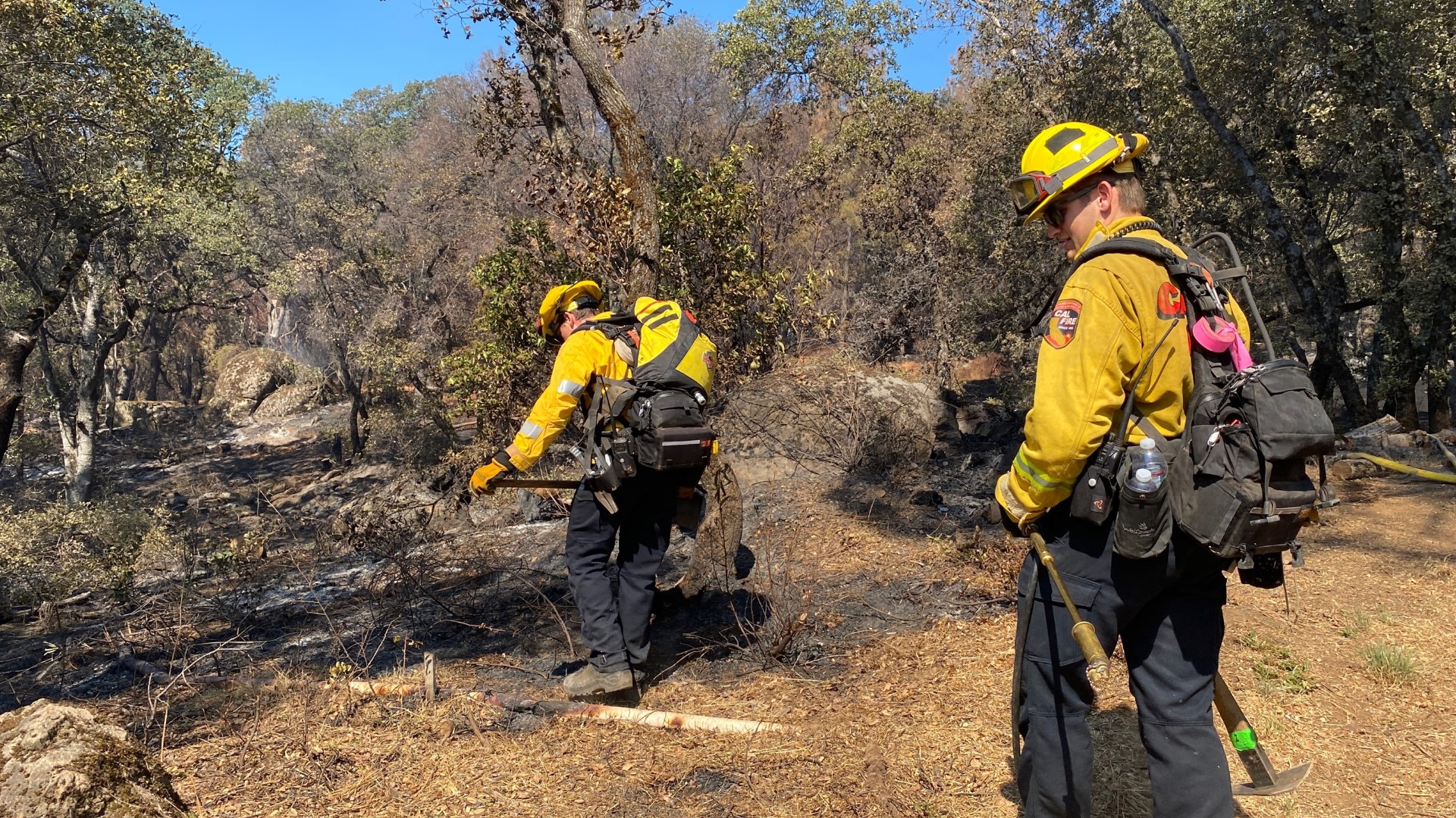
Fire officials say crews were able to take advantage of favorable weather, which allowed them to aggressively mop up the fire and reinforce containment lines.
Firefighters hope increased humidity and lower temperatures will help them protect 10 structures still said to be threatened by the Rices Fire, the largest active wildfire in the state as of Saturday. 13 structures have already been destroyed and another one damaged, CalFire said in a Saturday morning update.
The wildfire began with a building fire Tuesday in Nevada County near the Yuba River. It burned that building and three nearby outbuildings, fire officials said. The fire burned down to the Yuba River but did not cross over into neighboring Yuba County.
More than a dozen firefighters suffered dehydration and other heat-related injuries, authorities said.
Evacuation orders had been issued for 250 homes in small nearby communities but some of those orders were lifted Thursday as firefighters made progress.
About 132 animals have also been given refuge at the county fairgrounds.
KEY FIGURES:
- Acres: 904
- Containment: 35%
- Firefighter Injuries: 15
- Civilian injuries: 1
- Structures destroyed: 13
STAY INFORMED:
Evacuation Map
July 2 Update
Residents in Nevada County zone E029 along Rices Crossing, Troost Trail, Den Court, Mark Court and Cranston Road are still under evacuation orders.
Residents in zone CSP-E028 north of the South Yuba River and Pleasant Valley Road, South of Cranston Road, East of the Yuba River, Cranston Road and Rices Crossing Road and West of Pleasant Valley Road are also still under evacuation orders.
Those living in Nevada County's zone NCO-E029-B and NCO-E329 are under evacuation warnings.
Those areas include neighborhoods south of Birchville Road on Pleasant Valley Road to Denn Court, and south to Rices Crossing at Pleasant Valley Road. Areas north of Pleasant Valley Road and Jones Bar Road, south of the Middle Yuba River and Fair Haven Drive, and east of Pleasant Valley Road and Little Shady Drive are under evacuation warnings.
Live updates on evacuations can be found through the Zonehaven map below.
Evacuation Centers
- Madelyn Helling Library at 980 Helling Way
- Nevada County Fairgrounds at McCourtney Road open to animal shelters
Road Closures
- Pleasant Valley Road at Birchville
- Pleasant Valley Road at Bridgeport
- Birchville Road at Hwy. 49
- Pleasant Valley Road between Birchville Road and Bridgeport is open to residents only, with valid ID - this will be monitored by Grass Valley California Highway Patrol officers.
FIRE MAP
This wildfire map was created using data from NASA, NGA, USGS and FEMA.
WILDFIRE PREPS
According to Cal Fire, the 2021 fire season started earlier than previous years, but also ended earlier, as well. January 2021 saw just under 1,200 acres burned from nearly 300 wildfires. Fires picked up in the summer when the Dixie Fire burned in five Northern California counties — Butte, Plumas, Shasta, Lassen and Tehama. The Dixie Fire started on July 13 and wasn't contained until Oct. 25, burning nearly 1 million acres. It has since become the second-largest wildfire in state history and the largest non-complex fire.
Overall, 2.5 million acres were burned in 2021 from 8,835 wildfires. Over 3,600 structures were destroyed and 3 people were killed.
If you live in a wildfire-prone zone, Cal Fire suggests creating a defensible space around your home. Defensible space is an area around a building in which vegetation and other debris are completely cleared. At least 100 feet is recommended.
The Department of Homeland Security suggests assembling an emergency kit that has important documents, N95 respirator masks, and supplies to grab with you if you’re forced to leave at a moment’s notice. The agency also suggests signing up for local warning system notifications and knowing your community’s evacuation plans best to prepare yourself and your family in cases of wildfires.
Some counties use Nixle alerts to update residents on severe weather, wildfires, and other news. To sign up, visit www.nixle.com or text your zip code to 888777 to start receiving alerts.
PG&E customers can also subscribe to alerts via text, email, or phone call. If you're a PG&E customer, visit the Profile & Alerts section of your account to register.
What questions do you have about the latest wildfires? If you're impacted by the wildfires, what would you like to know? Text the ABC10 team at (916) 321-3310.


