
SACRAMENTO, Calif. —
Compared to recent storms, the totals picked up from this past weekend are somewhat modest, but still very impressive in what has been a winter to remember.
Low pressure systems continue to drop into California from the north, supplying the damp, brisk weather that has dominated 2023 thus far.
The system that dropped down this weekend will continue to spin up spotty showers on Monday and Tuesday. Snow is continuing to fall on both Highway 50 and Interstate 80 but they remain open, although chains are required on I-80 currently.
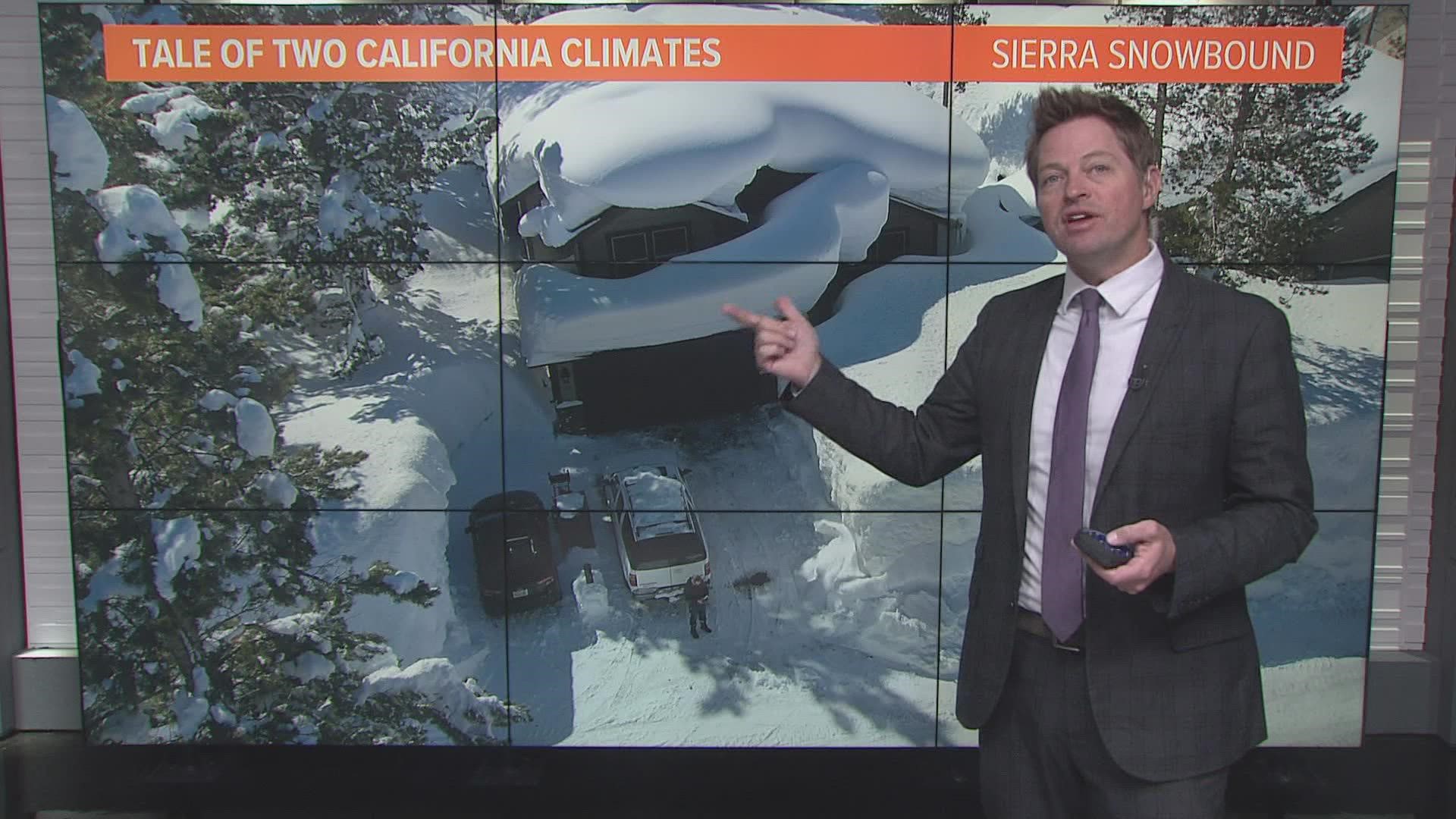
The majority of the precipitation associated with the system already fell this weekend. Low snow levels meant areas above 1,500 feet saw more snow while areas below saw rain.
Sugar Bowl led the way in snowfall accumulation on Saturday and Sunday, picking up 60”. The UC Berkeley Snow Lab received 48.5", Palisades received 36", and Kirkwood received 34".

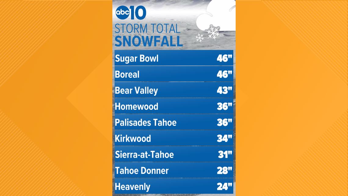
The Snow Lab is now at 48.33 feet of total snowfall this winter, surpassing the 2016/17 winter (the snowpack that winter had a higher water content, however). Statewide, the snowpack sits at 192% of average to date.
Much of the Sacramento Valley saw close to half an inch of rain while the San Joaquin saw lesser amounts, generally from a tenth to isolated areas seeing close to half an inch.
Sacramento picked up 0.45", Lodi received 0.78", Stockton received 0.40", Modesto received 0.43", and Folsom received 0.56".

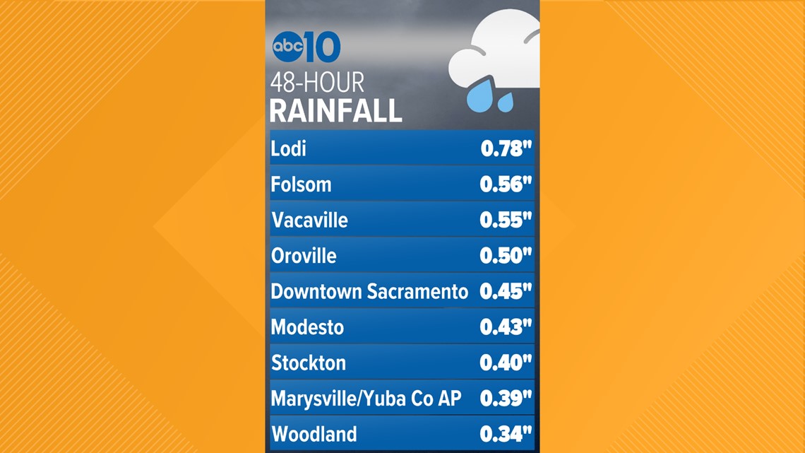
These totals will build with another tenth to half an inch expected in the valley by Wednesday and another 1-2 feet of snow in the Sierra.
Consensus is beginning to build in the models that an upcoming shift will result in warmer, wetter storms later this week. Storm systems will once again have access to tropical moisture in a similar manner to the deluge that occurred early this year.
Flooding concerns will renew with this pattern change considering snow levels will likely be upwards of 6,500-8,000 feet.
WATCH ALSO:


