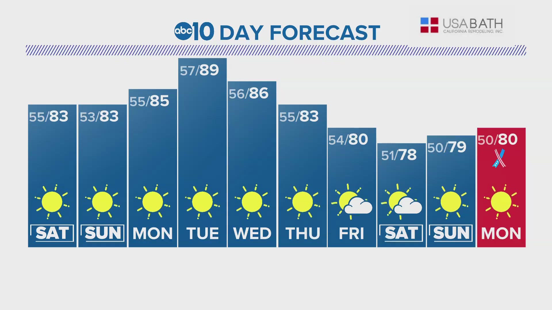
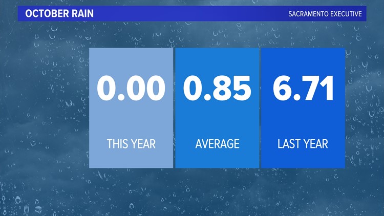
SACRAMENTO, Calif. — The weather pattern is about to flip after a dry October. The first winter-like storm is on the way, bringing much below-average temperatures and beneficial rain to the region, and it appears that more is on the way.
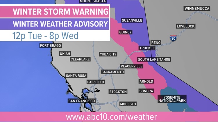
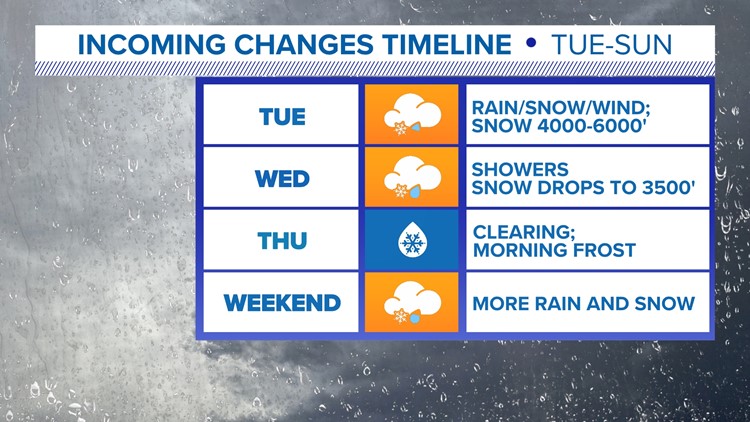
A cold front is poised to sweep through Northern California Tuesday, bringing widespread rain to the valley and snow to the mountains. Clouds and cooler temperatures filtered into the region Monday, setting up spooky Halloween conditions ahead of the approaching storm system.
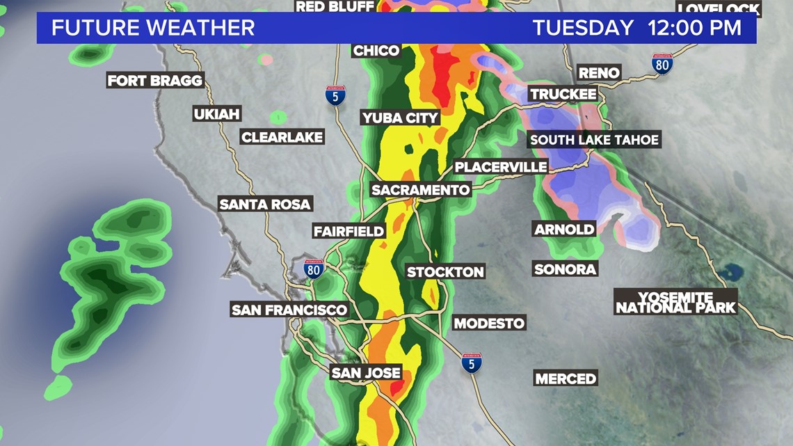
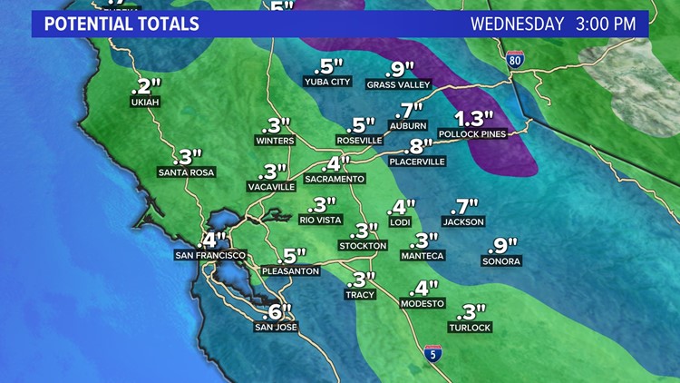
Valley rain totals have been trending up in the last 24 hours, with most valley locations expected to receive 0.25-0.50 inches.


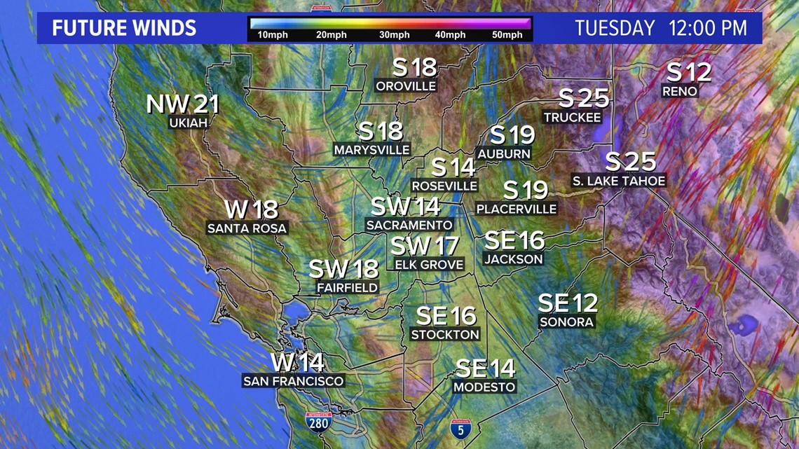
Expect the bulk of rain to fall from 11 a.m. to 3 p.m. on Tuesday as the narrow rain band pushes through interior northern California. Wind gusts up to 25 mph are expected in the valley and even stronger gusts are likely in the higher elevations.

Shower chances will continue through Wednesday, although totals following the initial band will be light except for locally higher totals in areas affected by thunderstorms. For now, thunderstorm chances look best for foothill areas and far eastern portions of the Sacramento Valley.

Once the skies clear on Wednesday night, cold overnight temperatures are expected. Widespread temperatures in the 30s are forecast for Thursday morning and even a few areas of frost are possible, according to the National Weather Service.
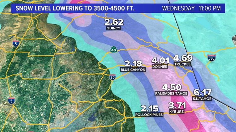
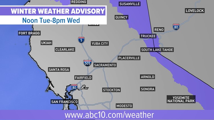
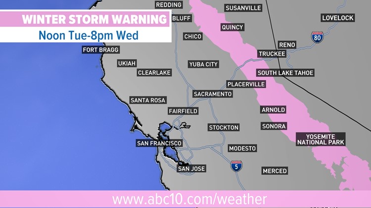
Ahead of the storm, the National Weather Service has issued it's first Winter Storm Warning of the season. Snow levels will start off high, around 7,000 feet, before the cold air associated with the system filters in. Snow levels will fall rapidly as the storm pushes inland, down to around 3,500 - 4,000 feet.


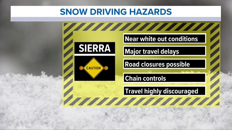
Snow totals are expected to fall between 8 - 24 inches, with locally higher amounts over the highest elevations. Travel is highly discouraged over the mountain passes with whiteout conditions possible. Chain controls and major travel delays are likely along both Interstate 80 and Highway 50.
The National Weather Service is calling on people to get their vehicles ready as the colder weather comes in, which includes getting their snow chains handy.
This week's storm system doesn't appear to be the last of its kind either. Model data is indicating that next weekend could be wet as well. The high pressure system that sat over California for much of October has retreated, allowing storms to move into the region.
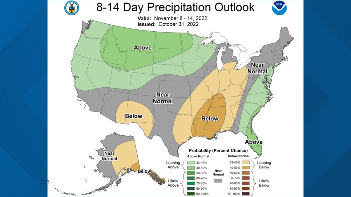
The Climate Prediction Center shows Northern California as having above-average precipitation chances over the next 8-14 days, which is reinforced by the North American Multi-Model Ensemble (NMME).

November Winter Storm | Forecast


WATCH ALSO: