SACRAMENTO, California —
Northern California temperatures are set to dip well below average thanks to an abnormally cool system of low pressure dropping down from the Gulf of Alaska.
This system will not only drop temperatures about 15-20 degrees below normal, but will also spin up some early-season rain and snow across the highest elevations.
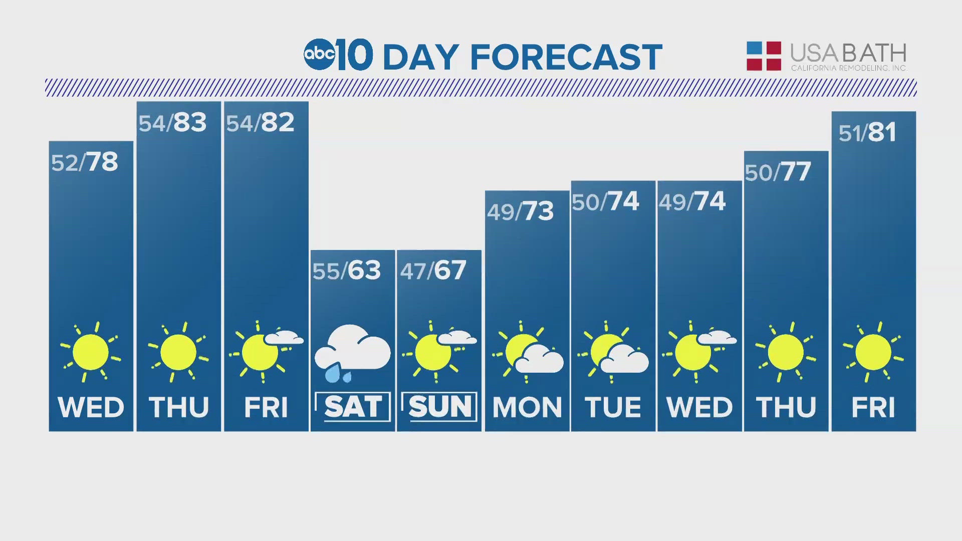
Before the pattern change, Thursday’s high temperatures will be about average to slightly below average. A high of 85 is forecast for Sacramento Thursday, along with clear skies and winds of 5-10 mph from the north.
Friday will see a slight drop in temperatures, which will be around 80 across the valley but the overnight hours will start to see the impacts associated with the trough as it digs into the region.
Saturday will be noticeably cooler across Northern California. High temperatures will be in the upper 60s to around 70 in the valley and Sierra highs will be in the 40s to near 50 with overnight lows dropping to the 20s. Sacramento hasn't had high temperatures in the 60s since early May.
Sunday will be a bit warmer but temperatures are only expected to peak in the mid 70s.
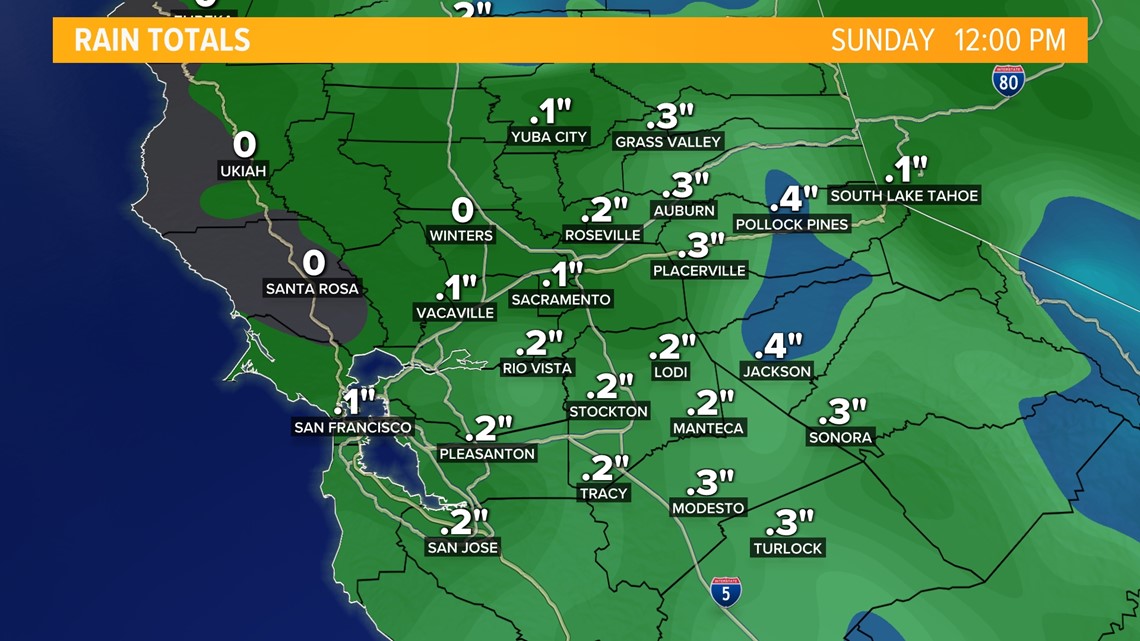
Rain chances will be highest in the valley Saturday morning. Totals will be highest across the Sierra and foothills, while valley locations will likely see less than a tenth of an inch. Showers are expected to be spotty, so some areas may miss out on rainfall entirely in the valley.

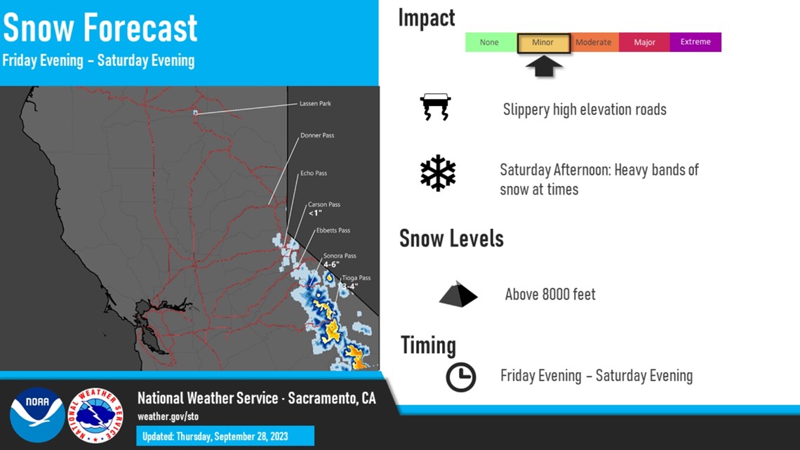
Showers will be present through Sunday across the Sierra, but snow chances will be greatest overnight Friday into Saturday.
The cold air ushered in by the system will help to drop snow levels to around 8,000 feet. Accumulation will be light but some of the higher passes to the south like Sonora and Tioga could see a few inches of fresh snow.

Unfortunately for fall weather enjoyers, high pressure is set to build into the West Coast next week and temperatures will rise to above-normal levels. Sacramento hasn't had a day with a high temperature above-average since Sept. 16.
The Central Valley will likely be looking at temperatures in the upper 80s and lower 90s by late next week and they could even rise higher than that depending on the strength and placement of the high pressure. The average high temperature in downtown Sacramento for Oct. 1 is 85 but by the end of the month, the average is 72.
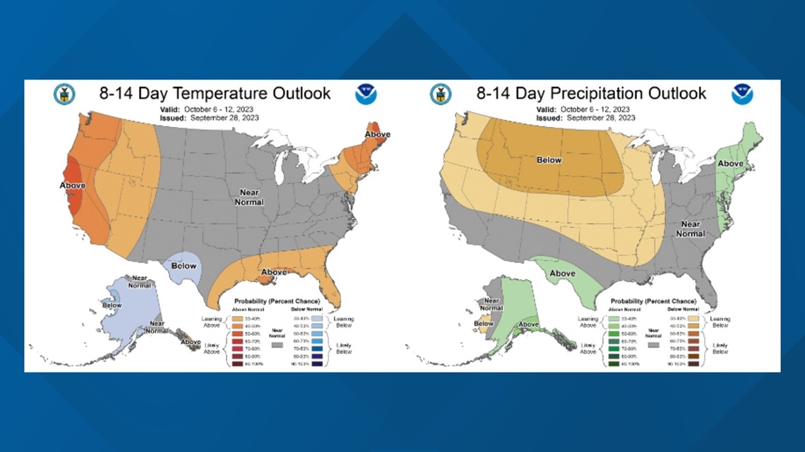
The Climate Prediction Center favors warm and dry weather once the system passes and this pattern can be expected through early October.