
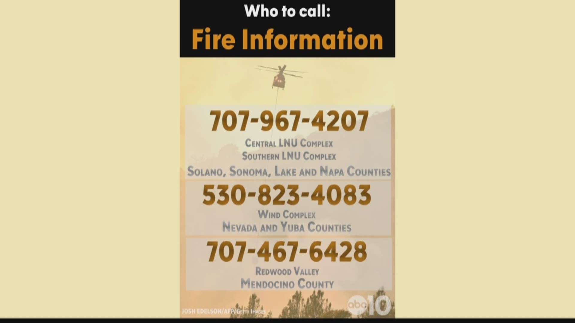
Wildfires burning across Northern California have killed at least 40 people, injured at least 180 more, and destroyed more than 5,700 homes and businesses.
Now, the state Office of Emergency Services is sharing an interactive map.
You can click on wildfires in your area and get updates on where the fire is burning, how big it is, how many people are fighting the fire, along with shelter information and road closures.
The map may take a moment to load. If you do not see it click here to access it.
Fire officials earlier shared another interactive map of the fires burning across the state.
Note: You can scroll to other parts of the state to see more fire information.
Fires burning in Northern California include massive fires in wine country along with fires in Yuba, Nevada and Butte counties.