
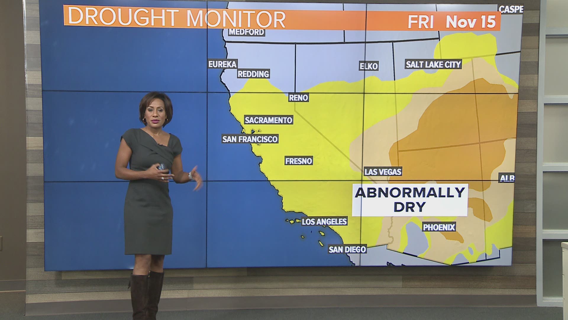
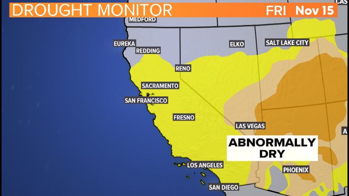
CALIFORNIA, USA — Drought conditions have returned to the Central Valley.
Our latest drought monitor focuses on the effects of above-normal temperatures combined with a dry monsoon season in Arizona and New Mexico and a lack of precipitation to start the water year in parts of California.
Coordination with state monitoring groups led to the expansion of D0 (Abnormally Dry/Yellow Shading) across the southern two-thirds of California.
While reservoirs remain high, numerous indicators support dryness. That includes 60-day precipitation deficits, high evaporative demand, and vegetation health.

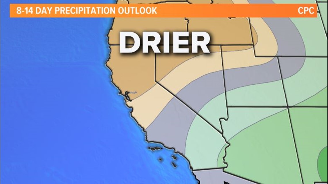
LONG RANGE WEATHER MODELS
RELATED: More fire weather next week?
Our long-range models, from the Climate Prediction Center, are showing drier than average conditions for the next 8-14 days.
There is a chance for light mountain showers next Wednesday through Thursday. However, this particular weather-maker may also bring gusty winds. For that reason, even though there is a possibility for light rainfall in the mountains, the likelihood for high winds has become the weather story.

FREE ABC10 APP:


►Stay In the Know! Sign up now for ABC10's Daily Blend Newsletter
WATCH ALSO: