
SACRAMENTO, Calif — The current cooler and wetter than normal weather pattern will continue with the arrival of two separate storm systems this week.
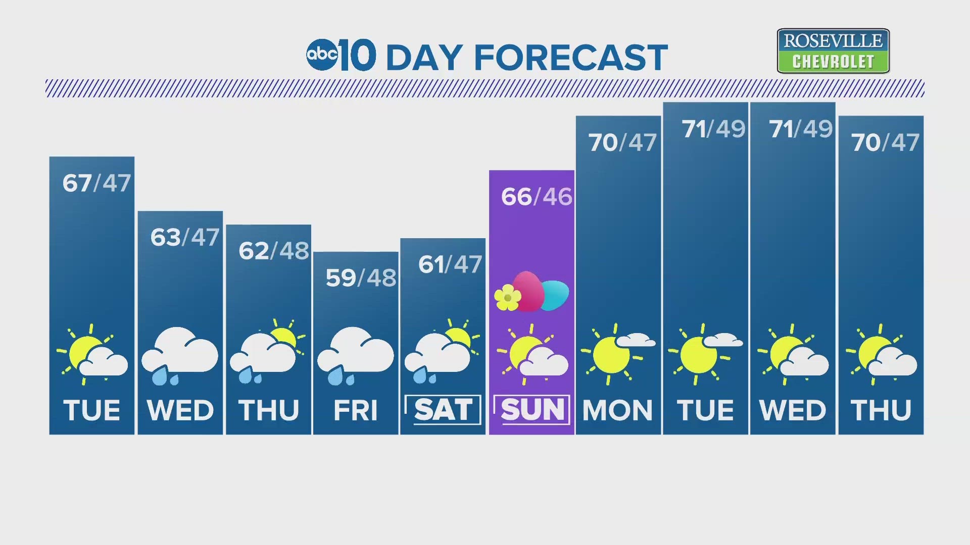
Before the first wave of precipitation arrives late Wednesday, a short-lived and weak high pressure system will move over the region. As a result, temperatures will rise into the mid to upper 60s Tuesday before temperatures drop again by Wednesday. The high temperature in Wednesday in Sacramento will likely be a degree or two cooler than the average high of 68.
Increasing cloud cover and cooler temperatures compared to Monday and Tuesday will prelude the arrival of a cold front Wednesday afternoon. Highs will be in the low to mid 60s in the valley, 50s in the foothills, and 40s and 30s in the Sierra.
The cold front will traverse Northern California from the northwest to the southeast and will bring rain to the Sacramento area around the evening commute. The heaviest of it will fall around midnight as the front passes through.
Locations south of Interstate 80 will only receive 0.1-0.25” from this first wave of precipitation and western central valley locations could potentially see even less. Around 0.5-1.5" is forecast in the foothills.
A Winter Storm Warning is in effect from 11 a.m. Wednesday until 11 a.m. Thursday for the western slope of the Sierra Nevada above 5,500 feet.
The heaviest snow will fall late Wednesday night into early Thursday morning with 6-12" expected for most of the area with up to two feet possible at the highest peaks.
Snow will continue through Thursday but it will be a mainly dry day in the valley apart from scattered showers.

Valley high temperatures will be in the lower 60s Wednesday and Thursday before dropping into the upper 50s by Friday.
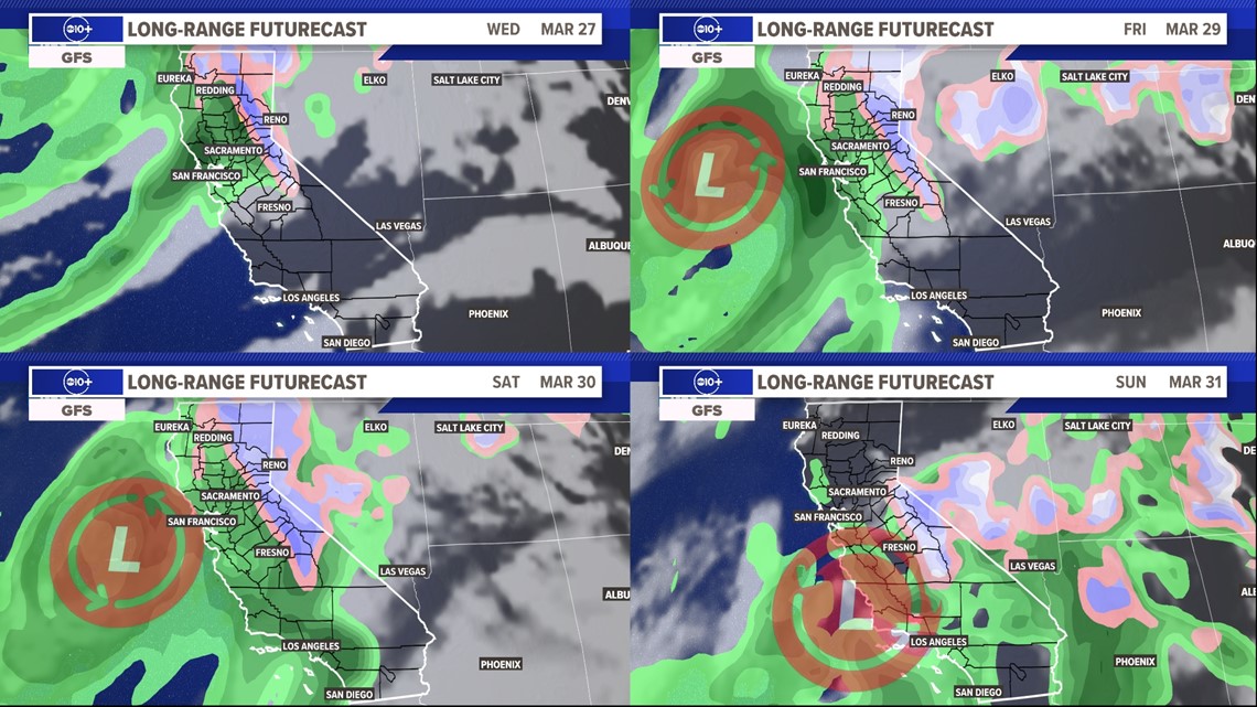
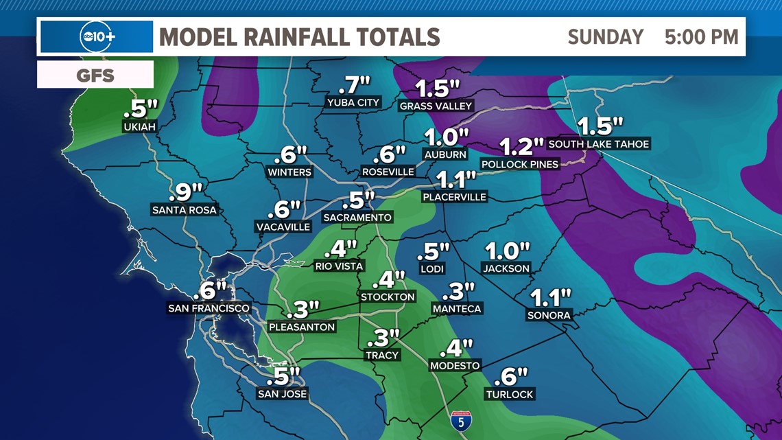
A secondary low pressure system will tap into moisture from an atmospheric river and will bring more rain and snow by Friday. The access to more moisture means this will be the wetter of the two systems, but both have been trending downwards in total rain and snowfall amounts. The graphic below shows precipitation totals through Sunday evening.

Rain will begin in the valley at a similar hour as compared to the Wednesday cold front. Rain and snow will continue through Saturday and early Sunday morning before the storm slides south, bringing heavy rain to Southern California.
The first few days of April will be warmer and drier but models are hinting towards another cooler and wetter pattern after that.