
CALIFORNIA, USA —
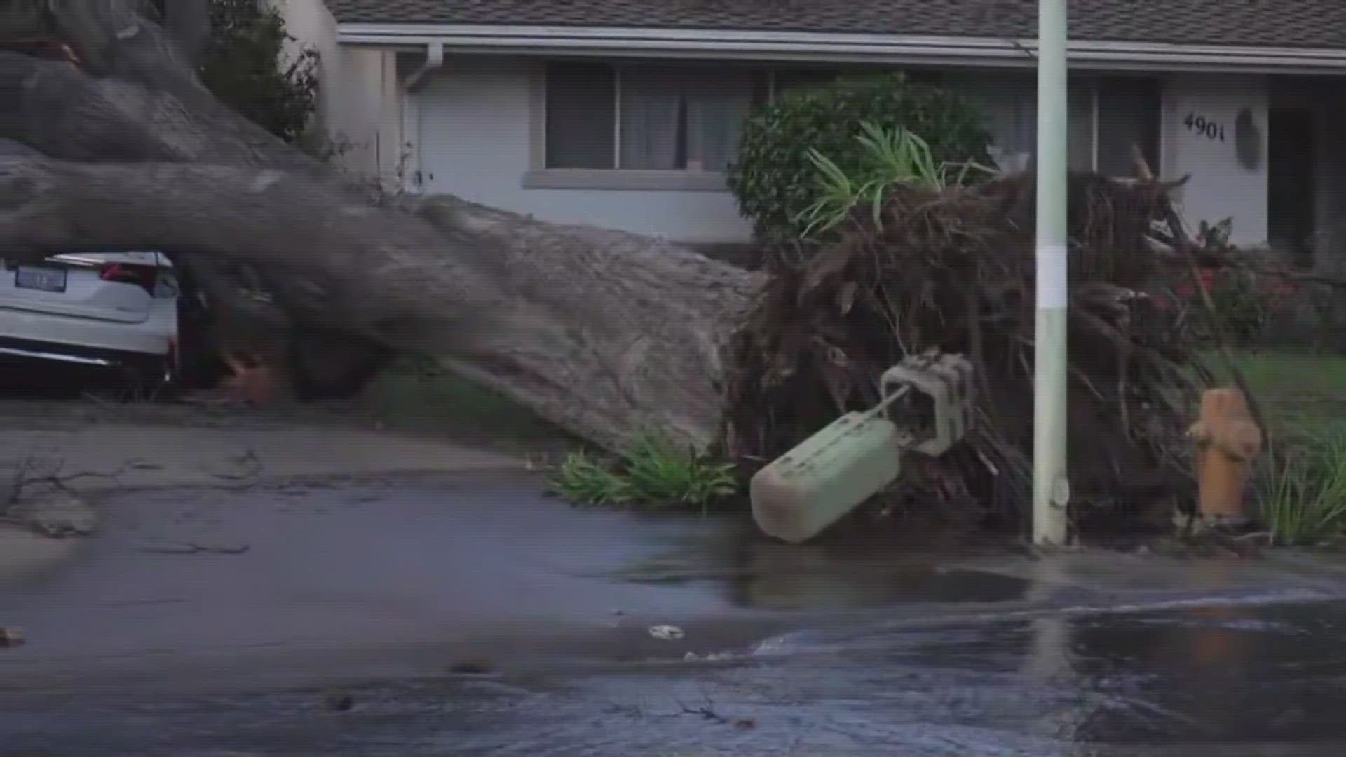
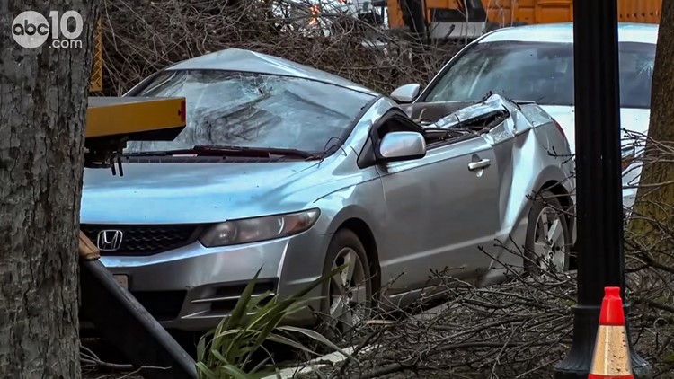
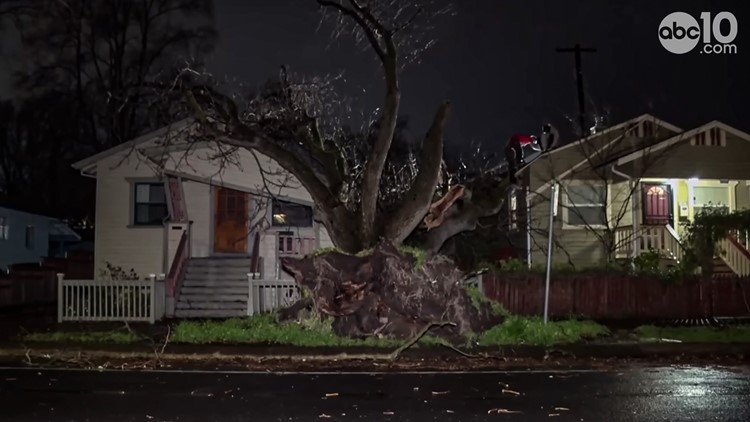
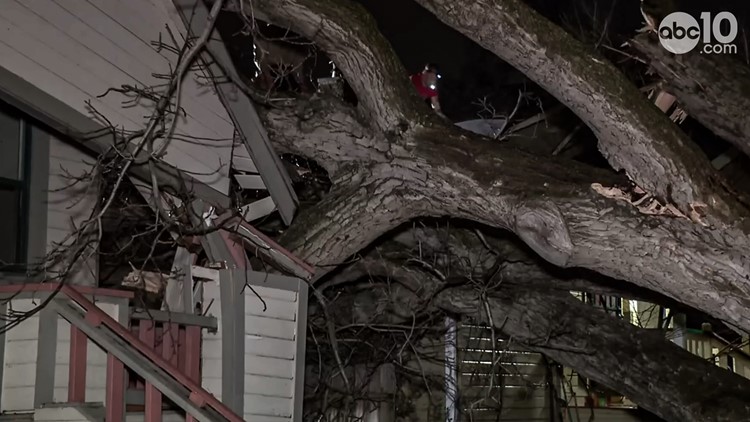
The second of back-to-back atmospheric rivers moved slowly through California on Monday, flooding roadways and knocking out power to hundreds of thousands of people.
Showers make their way across the southern Sacramento region Monday, and isolated thunderstorms are possible through the evening, according to National Weather Service Sacramento's 6:30 p.m. radar update.
The strongest winds of the storm are over for now with only breezy conditions in the morning. More scattered showers continue today with thunderstorms possible this afternoon.
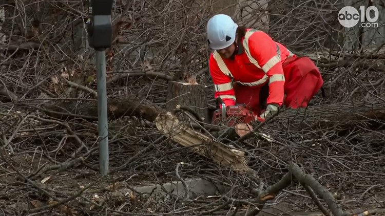
Sacramento County announced that a 41-year-old man died in Carmichael after a tree fell on him on Sunday.
David Gomes, 82, was killed Sunday in Yuba City after a large redwood tree fell on him in his backyard.
Around 8:30 a.m., the Santa Cruz County Sherriff's Office says a man was killed at his home along Highway 9 after the winds brought a tree down, according to the Bay Area's ABC7. A second person in the home escaped and called 911, but EMS and fire were unable to save the man, later identified as Robert Brainard, inside.
Here's a list of the active watches, warnings, and advisories issued by NWS Sacramento:
A Flood Watch is in effect from Sunday to Tuesday. Mudslides and rockslides are possible in the foothills. Flood-prone areas, urban areas, roads, parking lots, and small creeks could flood. Rivers will be running high, even compared to where we've been.
A Winter Storm Warning is in effect until Tuesday for the Sierra. 1-3 ft of snow is possible in the Coastal Range and 4-6 ft possible in the Sierra. Wind gusts of 55 mph or higher are expected.
Traffic
Sacramento Regional Transit Light Rail Blue Line service resumed at 2 p.m. Monday.
Green Line and a portion of the Gold Line, from Sacramento Valley to Power Inn, was scheduled to resume service at approximately 3:30 p.m., according to a SacRT social media post.
As of 4 p.m. Monday, Gold Line is available between the Sacramento Valley Station and 29th Street Station, SacRT said. A bus bridge is in place between 29th Street and Iron Point and Historic Folsom stations.
Here are the latest road conditions and an interactive Caltrans map.
Interstate 5
- A high wind advisory is in effect from the San Joaquin/Sacramento County Line to the Sacramento/Yolo County Line, according to Caltrans.
- A high wind advisory is in effect over the Elkhorn Bridge and over the Elkhorn Causeway /North of Sacramento in Yolo County.
Interstate 80
- Eastbound I-80: Eastbound trucks are being screened at Applegate in Placer County, according to Caltrans. Chains are required from 2.1 mi east of Baxter in Placer County to Truckee in Nevada County, according to Caltrans.
- Westbound I-80: Westbound trucks are being screened 5 miles west of Reno /at Mogul in Washoe County, according to Caltrans. Chains are required from the Donner Lake Interchange in Nevada County to 2.1 mi east of Baxter in Placer County, according to Caltrans.
- A high wind advisory is in effect over the Yolo Causeway and Bryte Bend Bride/west of Sacramento in Yolo County, according to Caltrans.
- A high wind advisory is in effect from the Yolo/Sacramento County Line to the Sacramento/Placer County Line.
- Just before 4 p.m. Monday, Caltrans crews were turning around all westbound I-80 truck and trailer traffic at the state line due to high traffic volumes in Truckee, according to a Caltrans social media post. The traffic was released roughly 30 minutes later.
Highway 50
- Chains are required from Twin Bridges to Meyers in El Dorado County, according to Caltrans.
- A high wind advisory is in effect from the Yolo/Sacramento County Line to the Sacramento/El Dorado County Line, according to Caltrans.
Road closures
Taylor Road is closed between East Roseville Parkway and the city of Rocklin due to significant power utility repairs, according to a city of Roseville social media post. The roadway is estimated to reopen late Wednesday, the city said. It recommends drivers choose an alternate route and travel with care.
Power Outages
Find PG&E power outages HERE. SMUD outage map can be found HERE and HERE's where to report an outage.
Sacramento County: Power outages: Tracking blackouts in Sacramento County
San Joaquin County: Power outages: Tracking blackouts in San Joaquin County
Yolo County: Power Outages: Tracking blackouts in Yolo County
Placer County: Power outages: Tracking blackouts in Placer County
Nevada County: Power outages: Tracking blackouts in Nevada County
Solano County: Power outages: Tracking blackouts in Solano County
Modesto area: Power Outages: Tracking blackouts in the Modesto area
School Closures and Delays
Find the latest school closures and delays HERE.
TRAFFIC
Sacramento region traffic map:
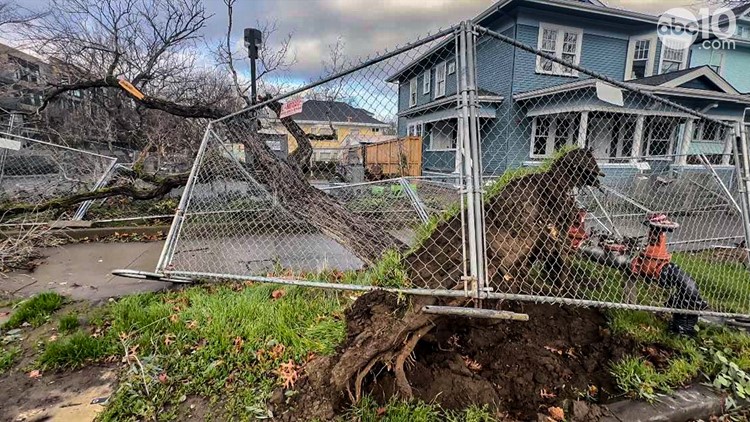
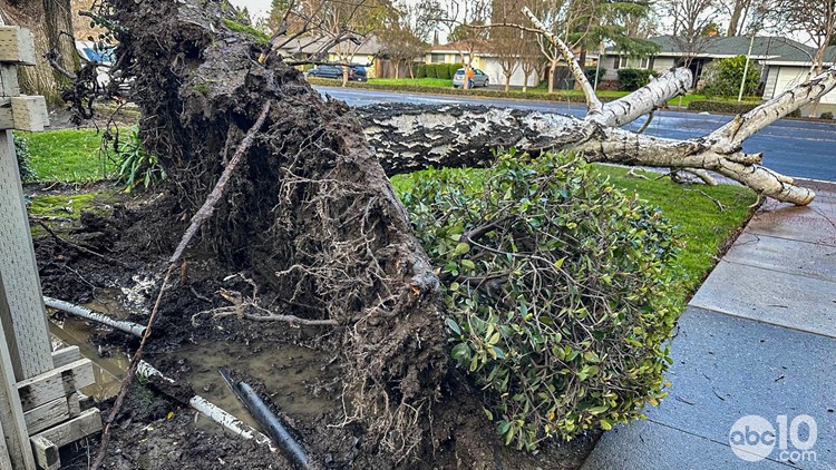
Storm damage in Sacramento after Northern California storms in early February 2024


Radar:
Radar map from ABC10.com. Adjust the layers with a filter on the bottom right corner to show rain, snow, wind and current temperatures:
STORM RESOURCES:
► RESOURCES | Helpful information and emergency resources to get you through this storm
► FORECAST DETAILS | Check out our hourly forecast and radar pages.
► GET WEATHER ALERTS TO YOUR PHONE | Download the ABC10 mobile app
► WEATHER IN YOUR EMAIL | Sign up for the ABC10 Today newsletter
Watch more from ABC10: California Storm Forecast: Atmospheric river storm, wind, rain and flood risk


