
SACRAMENTO, Calif —
Following a stretch of dry weather, a flip in the pattern is expected to bring widespread precipitation to California.
December has started off both warmer and drier than normal but a series of warmer storms starting on Sunday will add to those lacking precipitation totals.
Even though temperatures have been dipping near and even below the freezing mark across the valley the last seven days, Sacramento is still much warmer than normal this month at 1.8 degrees above average.
On the precipitation side, Sacramento Executive Airport has received 0.65” this month, well below the 3.43” Sacramento typically receives in December. The snowpack is off to a rough start as well with the statewide percent of normal only at 29%. Due to the warmer nature of this storm, it isn’t likely to add much snow to the Sierra.
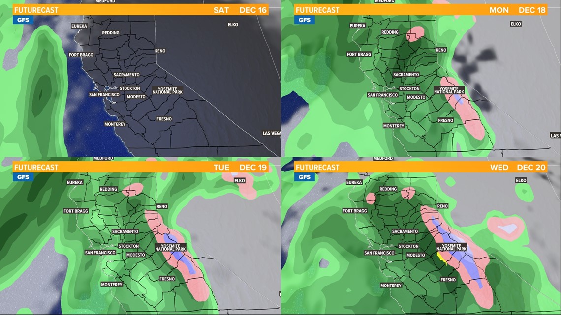
Beginning Sunday, a cutoff low pressure system and associated atmospheric river will take aim at Northern California. The counterclockwise rotation of the storm off the coast of California will draw in moisture from the tropics, hence the use of the term atmospheric river.
This moisture laden storm will primarily be a rain event due to high snow levels, although snow is still expected in the highest elevations. The mainly east to west storm path will usher in mild Pacific air rather than colder air from the Gulf of Alaska. High temperatures in the valley on Saturday will be in the mid 60s on Saturday and highs around 60 on Sunday.
Rain is expected to push into the valley on Sunday night, continuing through much of Monday, Tuesday and Wednesday.

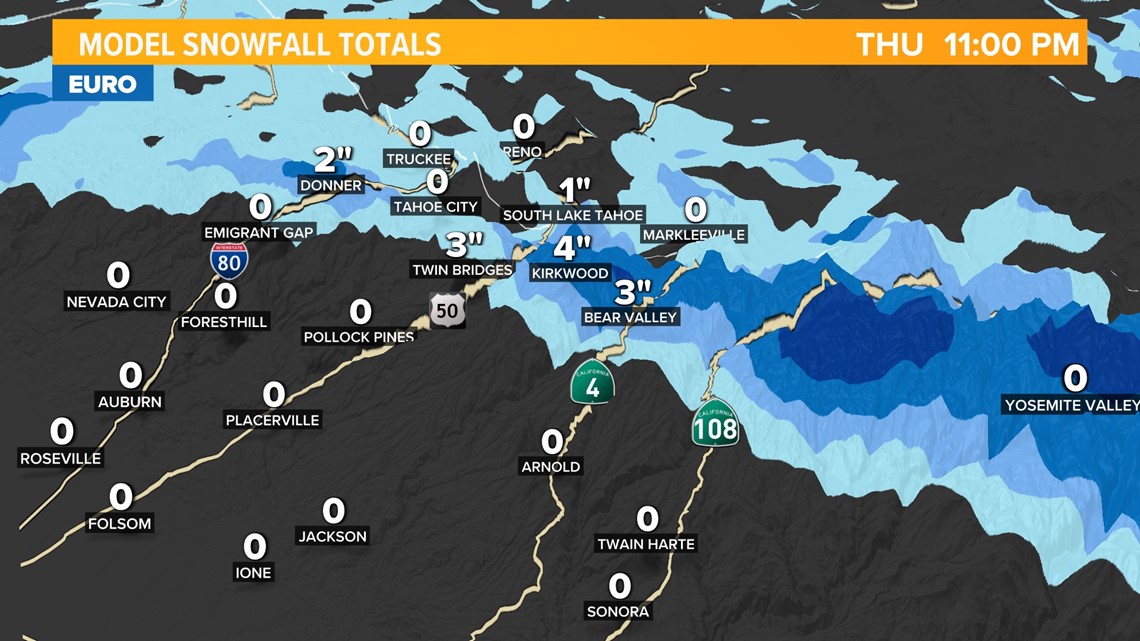
Initially, snow levels in the Sierra will be above 8,000 feet but will lower to as low as 6,000 feet by Wednesday.
There is still uncertainty in how much snow will fall in the Sierra given the fact that snow levels will continue to fluctuate in the coming days. However, this storm is not expected to be a major snow maker and most Sierra locations will see less than a foot of wet snow.

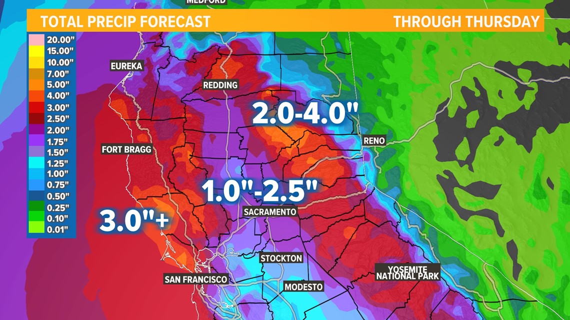
Rain totals will be on the higher side with 1-2.5" in the valley through Thursday. Rain will be higher along the coast and into the foothills and Sierra and up to 4" is expected.

WATCH ALSO:


