
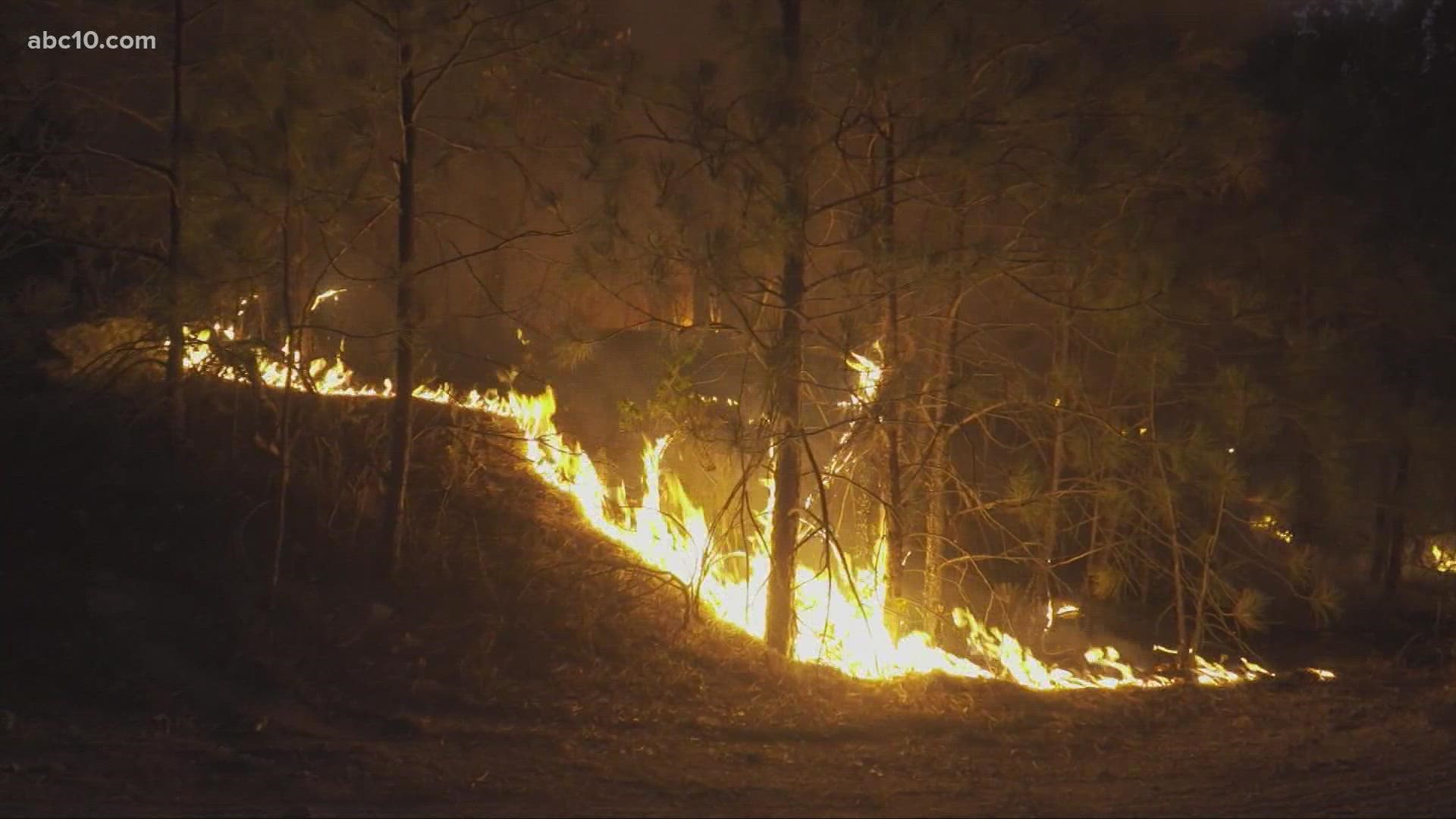
TUOLUMNE COUNTY, Calif. — According to the Cal Fire Tuolumne-Calaveras Unit, the Washington Fire initially consisted of two separate locations. The fire has remained at 81 acres burned and is now 10% contained.
According to the latest update, evacuation orders are expected to be lifted Friday for all areas except "Stockton Road from the intersection of Stockton Road and Highway 108 to the intersection of Stockton Road and Ponderosa Road."
The power continues to be out in areas of Sonora due to damaged power lines.
The cause of the fire is under investigation.
Detailed information on evacuations can be found on the Tuolumne County Sheriff Facebook page.
Evacuations and Road Closures:
Orders:
Hwy 108 from Stockton Road to Washington and south Washington to Hwy. 108
Warnings:
- City of Sonora
- Panorama Drive
- Rough and Ready
- Gibbs
- Jamestown Road
- Racetrack Road
- Mill Vila Estates
Centers:
- Tuolumne Memorial Hall - 18375 Fir Ave. Tuolumne, CA
- Westside Pavillion Rv’s and Trailers - 17807 Tuolumne Rd. Tuolumne, CA
- For small animals: Jamestown Animal Control - 10040 Victoria Way Jamestown
- For large animals: Frogtown Fairgrounds - 2465 Gun Club Dr. Angels Camp
Road Closures
- Hwy. 108 from Wigwam Road and Jamestown to Stockton Road
- Stockton Road From Hwy. 108 to Southgate Drive
Accounts to follow
Wildfire Map
A map by ArcGIS reflecting the acreage of the Washington Fire is available below.
Evacuation Map
A map of evacuations from the Tuolumne County Sheriff's Office is available below.
Wildfire Preps
According to Cal Fire, 2020 was one of the most severe fire seasons on record as 9,917 wildfires burned 4.2 million acres. Over 9,000 structures were destroyed, and 31 people (civilians and firefighters) were killed.
California also experienced its first "Gigafire" because of the August Complex Fire, burning over 1 million acres by itself. Four of California's top five largest wildfires in state history happened in 2020.
If you live in a wildfire-prone zone, Cal Fire suggests creating a defensible space around your home. Defensible space is an area around a building in which vegetation and other debris are completely cleared. At least 100 feet is recommended.
The Department of Homeland Security suggests assembling an emergency kit that has important documents, N95 respirator masks, supplies to grab with you if you’re forced to leave at a moment’s notice. The agency also suggests signing up for local warning system notifications and know your community’s evacuation plans best to prepare yourself and your family in cases of wildfires.
Some counties use Nixle alerts to update residents on severe weather, wildfires, and other news. To sign up, visit www.nixle.com or text your zip code to 888777 to start receiving alerts.
PG&E customers can also subscribe to alerts via text, email, or phone call. If you're a PG&E customer, visit the Profile & Alerts section of your account to register.
What questions do you have about the latest wildfires? If you're impacted by the wildfires, what would you like to know? Text the ABC10 team at (916) 321-3310.
►Stay in the know! Sign up now for the Daily Blend Newsletter
WATCH MORE ON ABC10: California Wildfires: Caldor Fire and Washington Thursday night update