PLACER COUNTY, Calif. — Find the latest updates on the Mosquito Fire HERE.
Cal Fire officials say its an "all hands on deck operation" after the Mosquito Fire jumped the American River Tuesday afternoon.
“This afternoon, the fire got across the American River from the south side onto the north side again, made a run up the canyon walls and is impacting the Foresthill area right now,” said Cal Fire spokesperson Jim Mackensen.
Officials are urging residents still in evacuation zones across Placer and El Dorado County to leave their homes immediately.
Placer County Sheriff's officials reported evacuating 5,976 residents from their homes—while 90 others refused to comply. Deputies also arrested two additional people in the area Tuesday.
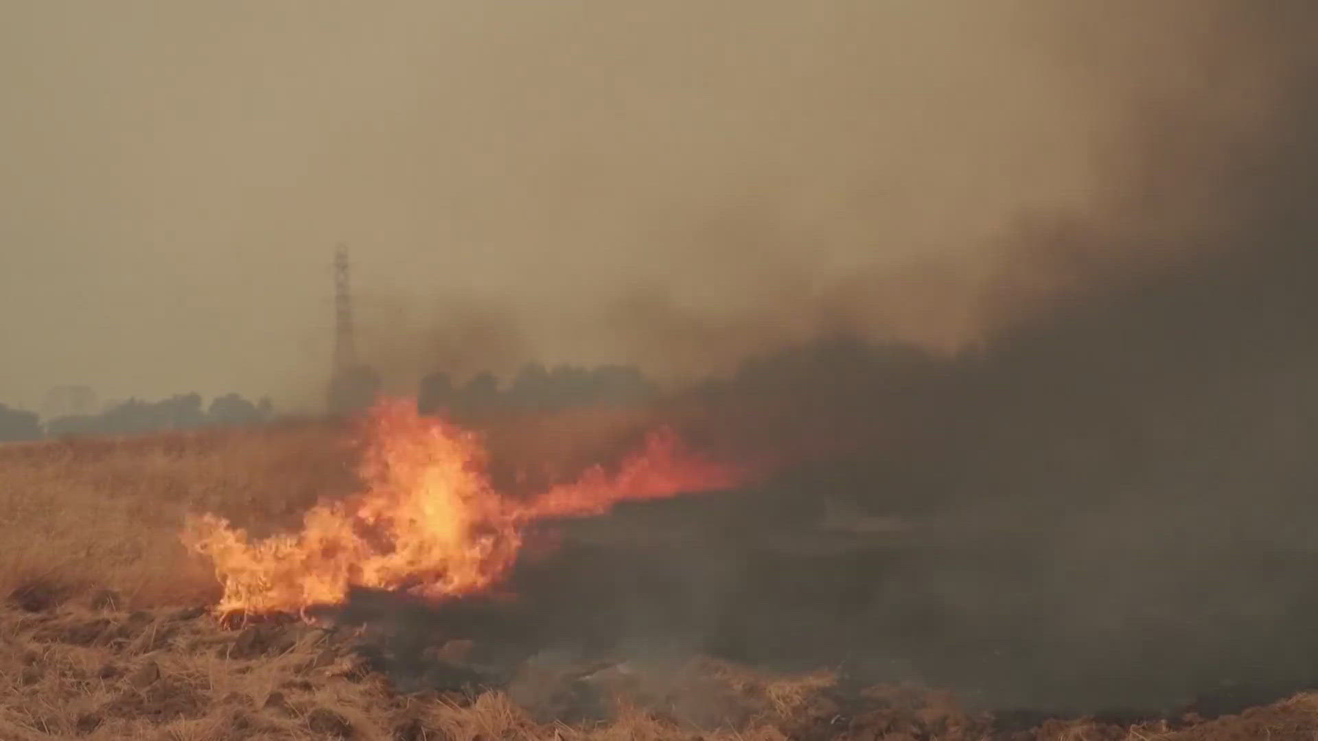
The Mosquito Fire in the foothills east of Sacramento has burned 50,330 acres as of Cal Fire's most recent update. Officials confirmed that 46 total structures have been destroyed with over 5,000 still threatened.
The latest National Fire Situational Awareness map shows the fire moving to the east. It is 25% contained.
Cal Fire's fire behavior analyst Jonathan Pangburn said firefighters are burning potential wildfire fuel east of the fire to prevent it from spreading any further.
"When the fire comes and approaches, in this case Foresthill Road ... it will be devoid of fuel and not be able to extend further," Pangburn said Tuesday.
He also said heavy smoke in the area over the past few days helped slow down the fire, but as weather changes, wind speeds pick up.
Officials also reported no fires progressing south of Stumpy Meadows.
Because of the increase in fire activity Tuesday, Placer County and El Dorado County Sheriff's Offices issued new evacuation zones.
The Placer County Sheriff's Office issued new evacuation orders for the Yankee Jims and Shirttail Canyon area, Tuesday. The boundaries of the new evacuation orders are north of Yankee Jims Road, south of Big Dipper through Kings Hill and through Black Bear and Grills Hill.
The El Dorado County Sheriff's Office issued additional evacuation orders for the Stumpy Meadows area, Tuesday. The boundaries for the area are east of Stumpy Meadows, west of the Wentworth Springs Road and Ice House Road intersection, south of the County Border and North of Onion Creek.
More than 5,800 structures in Placer and El Dorado counties were under threat and more than 11,000 residents of communities including Foresthill, Volcanoville and Georgetown are under evacuation orders.
► Scroll down for evacuation maps and other fire resources.
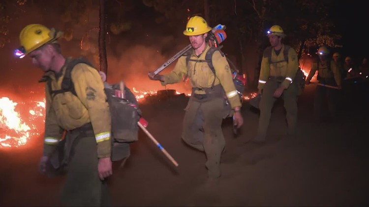
PHOTOS: Scenes from the Mosquito Fire
RELATED: Pyrocumulus: What is it and how does it form?
RELATED: How to check the air quality where you live
The Mosquito Fire’s cause is under investigation. Pacific Gas & Electric said unspecified “electrical activity” occurred close in time to the report of the fire on Tuesday.
Stay Informed
Live Evacuation Maps
Placer County Sheriff's Office evacuation map (You need to click the "I Understand" box to use the map):
El Dorado County Sheriff's Office evacuation map (You need to click the "I Understand" box to use the map):
STAY INFORMED WITH ABC10:
► ABC10 In Your Inbox: Sign up now for our daily newsletter for local headlines, weather, tips and even something to make you smile.
► ABC10 On Demand: Get access to our local news, live programming and weather with the free ABC10 app for Roku and Amazon Fire TV.
Evacuation Centers
Evacuation centers:
- Rocklin: Sierra College at 5100 Sierra College Blvd
- Cameron Park: Cameron Park Services District at 2502 Country Club Drive
- Overnight shelter, meals, showers, limited health services, and parking for trailers will be provided. Animals in crates and carriers will be accepted.
- Placerville: Green Valley Community Church at 3500 Missouri Flat Rd.
- No Large animals or no birds. Limited RV parking and no hookups
For large and small animals:
- Nevada County Fairgrounds on 11228 McCourtney Road, in Grass Valley Check-in at Gate 8
- Placer County Animal Services Center at 11232 B Avenue in Auburn
- No birds/chickens due to avian flu
- Gold Country Fairgrounds, 209 Fairgate Road, Auburn, California is opening on September 14
Fire Map
This map from the National Interagency Fire Center shows fire activity (this may take a few seconds to load):
Road Closures
For a Waze map with current road closures, click here.
Watch more on ABC10