

CALIFORNIA, USA — Northern California isn't done with rainy weather just yet. After a series of atmospheric river storms, Friday is expected to be another wet day starting in the afternoon.
A Winter Storm Warning goes into effect Friday afternoon with dangerous mountain travel through the holiday weekend.
Be prepared for rapidly changing weather conditions this afternoon. The primary threats with these storms will be brief but could bring heavy downpours and gusty winds.
Watches, Warnings, and Advisories in effect:
- A Winter Storm Warning from Friday at 1 p.m. through Monday at 10 p.m.
Evacuations
Solano County
An evacuation warning is in effect in Fairfield for potential flooding if Lake Curry spills into Suisun Creek. Areas that would be impacted include the Vines on 80 apartments, the Verdant at Green Valley Apartments and residents at Thomasson Lane. If the evacuation warning becomes an order, then people will have to move quickly to leave. Read more HERE.
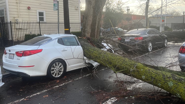
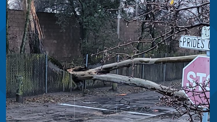
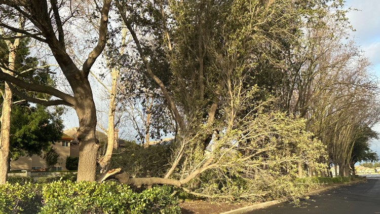
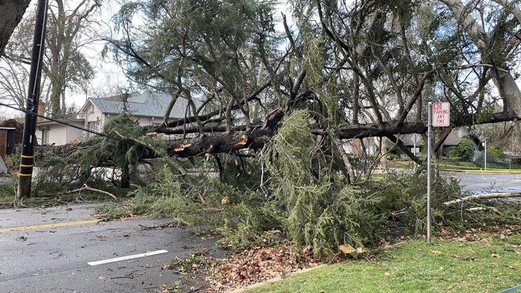
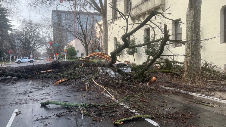
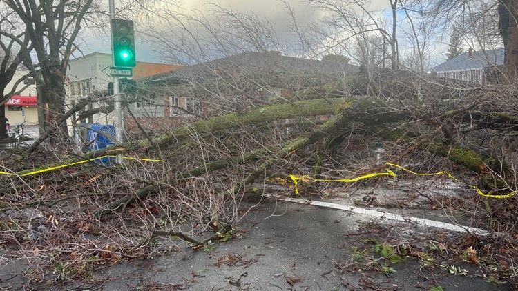
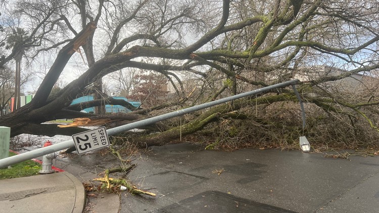
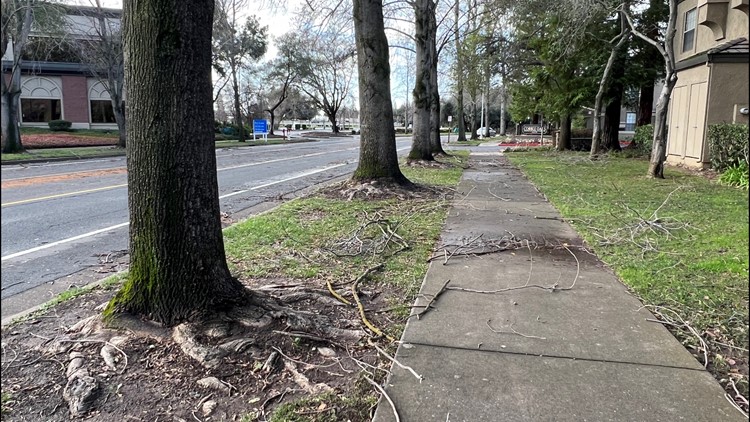
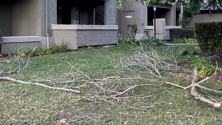
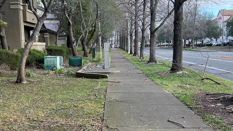
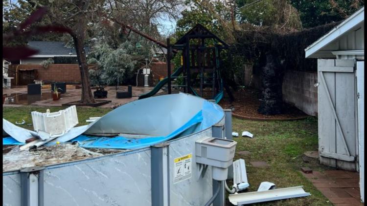
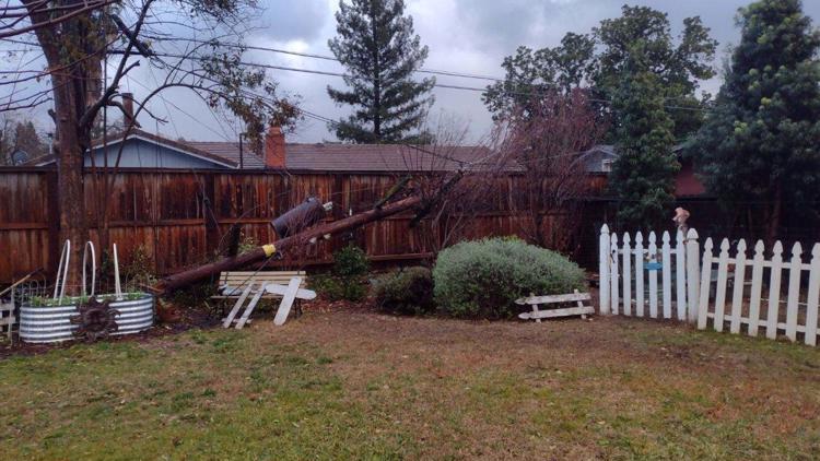
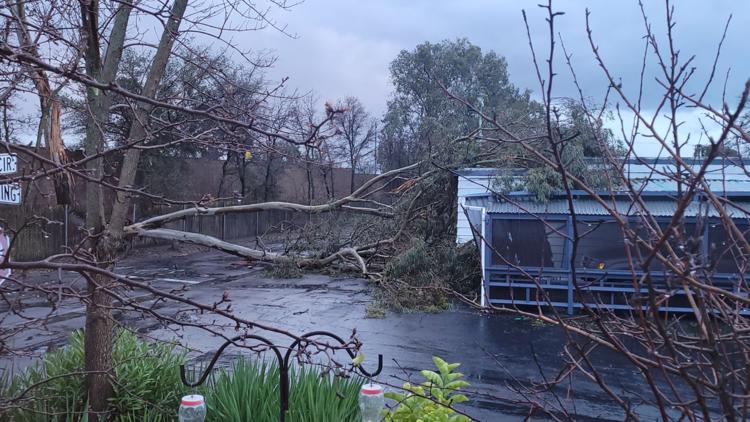
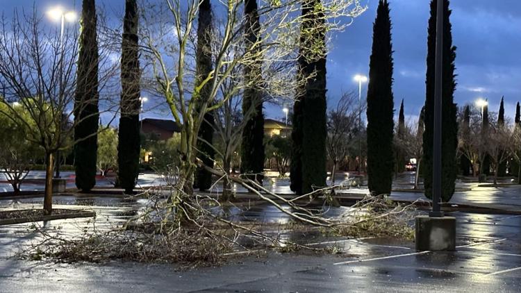
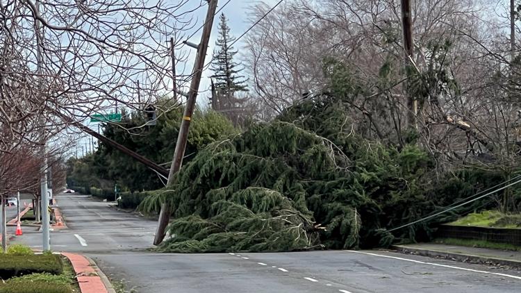
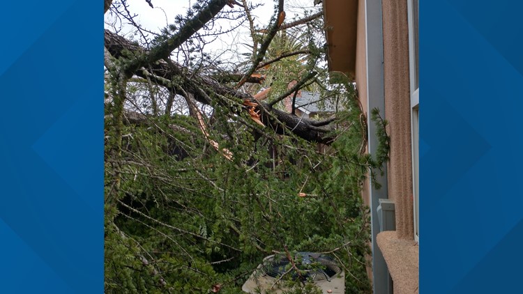
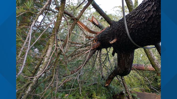
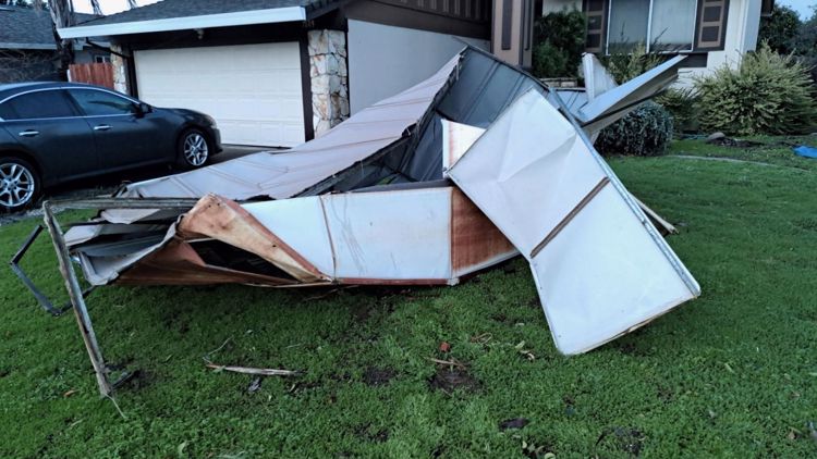
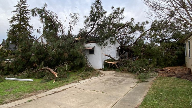
► STORM SCENES: Photos and video of the latest storm damage
Maps
Radar map from ABC10.com. Adjust the layers with a filter on the bottom right corner to show rain, snow, wind and current temperatures:
STORM RESOURCES:
► RESOURCES | Helpful information and emergency resources to get you through this storm
► FORECAST DETAILS | Check out our hourly forecast and radar pages.
► GET WEATHER ALERTS TO YOUR PHONE | Download the ABC10 mobile app
► WEATHER IN YOUR EMAIL | Sign up for the ABC10 Today newsletter
Chain Controls and Road Closures
Interstate 80
- No restrictions as of 6:30 a.m.
Highway 50
- No restrictions as of 6:30 a.m.
Highway 49
- Highway 49 is closed due to rockslides from Lincoln Way to the North Fork American River Bridge, according to California Highway Patrol. Read more HERE.
Highway 88
- Trucks over 65 are prohibited from the junction of Highway 49 in Amador County to the Nevada state line, according to Caltrans.
Highway 4
- Closed from 0.7 miles east of Farmington to 3.4 miles east of Waverly Road in San Joaquin County due to flooding, according to Caltrans.
- Closed from the east end of Lake Alpine to the Ebbetts Pass in Alpine County, according to Caltrans.
- One-way traffic at the Contra Costa/San Joaquin County line 24 hours a day through June 16 due to construction, according to Caltrans.
TRAFFIC
Live map showing traffic conditions along Interstate 80, Highway 50, and Highway 89 around Lake Tahoe and the Sierra Mountains.
Snow Park locations are identified with purple markers.
Sacramento Valley traffic from Waze (zoom in to where you want to go):
Power Outages
PG&E power outages:
SMUD outages can be found HERE.
Roseville Electric Utility outages can be found HERE.
Lodi Electric Utility outages can be found HERE.
Click HERE for more ABC10 weather maps.
Sandbags
Counties across Northern California are offering sandbags to residents. Locations are listed HERE.
YOUR PHOTOS: Storm damage in Northern California 1/8


Watch more on ABC10